River Seven facts for kids
Quick facts for kids River Seven |
|
|---|---|

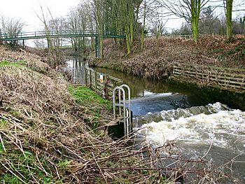
The Seven near Normanby
|
|
|
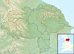
Location of the mouth within North Yorkshire
|
|
| Country | England |
| Counties | North Yorkshire |
| Physical characteristics | |
| Main source | Rosedale Head |
| River mouth | Rye at Brawby 54°11′13″N 0°51′51″W / 54.1870°N 0.8642°W |
| Length | 25 km (16 mi) |
The River Seven is a river located in North Yorkshire, England. It starts high up on Danby High Moor, which is in the middle of the North York Moors. From there, it flows south for about 15 miles (24 km). Finally, it joins another river called the River Rye near a village named Brawby.
As the River Seven leaves Danby High Moor, it travels through a beautiful area called Rosedale. It also flows past the village of Rosedale Abbey. In its lower parts, the river doesn't flow in a straight line. Instead, it forms winding curves, which are called meanders. These curves happen because the river flows around hills that stick out, known as interlocking spurs.
Many villages are built along the lower part of the River Seven. Some of these villages are very old, dating back to the 12th century or even earlier. These communities likely wouldn't exist without the river. For early settlers, the river was often their only source of fresh water. Its flood plains also provided rich, fertile land for farming. People also depended on the river for fishing and for washing. You can even find fossils in the rock layers along the river, especially in the Jurassic rock.
What is the Geology of the River Seven?
The River Seven is a small river, so it doesn't change the land's geology very much. However, over a long time, the river has helped to show different types of rocks. For example, you can see deposits from the last ice age in the riverbed.
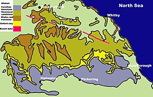
The area around the River Seven has rocks from three different time periods:
The main types of rocks found here include Corallian Limestone (which is often the top layer), Oxford Clay, Raven-scar Limestone, Shales, and Ironstone. These rocks are grouped based on their type and when they formed. Over many years, the North York Moors are slowly sliding downhill. We can see this happening because new layers of rock are becoming visible in the northern parts of the area.
How Does the River Seven Flow?
Since 1974, scientists have been measuring the water levels and how fast the River Seven flows. They do this at a special structure called a weir, located near Normanby. This weir is in the lower part of the river. Records from the past forty years show that the area of land that drains into the river (called the catchment) is about 122 square kilometers (47 sq mi) up to the measuring station. The river's average flow in this area is about 1.6 cubic meters per second (57 cu ft/s).
The catchment area upstream of the measuring station gets about 875 millimeters (34.4 in) of rain each year. The highest point in this area is about 433 meters (1,421 ft) above sea level. Most of the land here is rural, meaning it's not developed. It's covered by grasslands, forests, and moorland, especially in the higher parts of the river. The River Seven flows naturally, meaning its flow is not changed by human-made structures like dams or canals.
What Settlements Are Along the River Seven?
Many villages and towns are located along the River Seven. These communities have grown over time, often relying on the river for water and resources. Some of the main settlements include:
- Thorgill
- Rosedale Abbey
- Cropton
- Appleton-le-Moors
- Sinnington
- Marton
- Normanby
- Great Barugh
- Brawby
 | Emma Amos |
 | Edward Mitchell Bannister |
 | Larry D. Alexander |
 | Ernie Barnes |


