River Tawe facts for kids

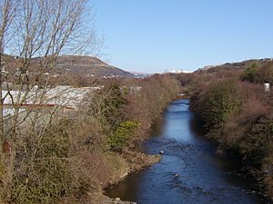
The River Tawe (which is Afon Tawe in Welsh) is a river in South Wales. It is about 30 miles (48 kilometers) long. The river starts high up in the Black Mountains. This area is part of the Brecon Beacons National Park.
The Tawe flows east at first, then turns south and southwest. It finally reaches the sea at Swansea in a wide area called an estuary. Some smaller rivers, like the Upper and Lower Clydach Rivers and the Afon Twrch, flow into the Tawe.
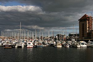
The river goes through towns and villages such as Ystradgynlais, Ystalyfera, Pontardawe, and Clydach. It ends its journey in Swansea Bay. The valley where the River Tawe flows is often called the Swansea Valley.
For a long time, the riverbed of the Tawe has been owned by the Duke of Beaufort's family. This ownership started in the 1600s with King Charles II. This means they have special rights, like for minerals and fishing. They even need to give permission and be paid for bridges built over the river. For example, in 2008, Swansea Council had to pay a large sum for a bridge.
River Tawe's Past
The lower part of the Tawe valley was a very busy industrial area in the 1700s and 1800s. Many factories refined metals like copper, lead, and zinc. There was also some porcelain making. Because of this, some parts of the valley still have soil affected by these old industries.
Today, the only big factory left from that time is a nickel refinery in Clydach. It is part of a Canadian company called Vale Inco.
Luckily, the river's water quality has greatly improved over the years. Now, large salmon swim up the river to lay their eggs. There are also many trout living in the river.
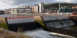
In 1992, a special wall called a barrage was built at the river's mouth. This helps control the water levels.
You can also find National Cycle Route 43 along much of the river. This path is great for cycling and walking.
Bridges Over the River Tawe
Many bridges cross the River Tawe, especially in the City and County of Swansea. Here are some of them, listed from north to south:
- The A4067 (Ffordd Cwm Tawe) road bridge.
- The B4291 road bridge at Glais.
- Another A4067 road bridge.
- A disused railway bridge that was once part of the GWR.
- The M4 motorway bridge.
- A railway bridge that is part of the Swansea District Line.
- The Swansea Vale road bridge.
- The A48 Morriston road bridge, which connects Morriston to the Swansea Enterprise Park.
- Beaufort Bridge, an old crossing point.
- Mannesmann pedestrian and cycle bridge, linking the Enterprise Park to Plasmarl.
- The famous Landore railway viaduct, part of the South Wales Main Line.
- Morfa footbridge, connecting the Morfa Retail Park to the Swansea.com Stadium.
- White Rock Bridge, for cars and people, linking Landore with Bon-y-maen.
- Parc Tawe Bridge, a road and pedestrian bridge.
- Quay Parade Bridge, for cars and people.
- Old Swansea Bridge, a former railway bridge where only the supports remain.
- Sail Bridge, a modern bridge for walkers and cyclists near the Maritime Quarter.
- Trafalgar Bridge, another pedestrian and cycle bridge near the Swansea barrage. This bridge cost £1.2 million to build. Part of it can swing open with the lock gates.
What's Next for the River Tawe?
There are plans to build more homes on both sides of the River Tawe. There is also an idea to have river taxis that could take people along the river.
In 2015, a study was done to find ways to better connect the city areas on the west side of the river with the more natural areas like Kilvey Hill and Crymlyn Bog to the east. This study suggested several ideas to make these connections stronger.
 | Laphonza Butler |
 | Daisy Bates |
 | Elizabeth Piper Ensley |


