River des Peres facts for kids
The River des Peres (pronounced "duh PAIR") is a 9.3-mile (15 km) long river in St. Louis, Missouri. It is a very important part of the city's water system. The river helps manage both dirty water (sanitary) and rainwater (storm water) for St. Louis and parts of St. Louis County. Its biggest smaller rivers that flow into it are Deer Creek and Gravois Creek.
Contents
River des Peres: Where It Is
The River des Peres starts in Creve Coeur, Missouri. It then flows into the Mississippi River near the River City Casino in St. Louis.
- Mouth
- Confluence with the Mississippi River near River City Casino, St. Louis: 38°31′59″N 90°15′38″W / 38.53311°N 90.26067°W
- Source
- Creve Coeur, Missouri: 38°40′43″N 90°24′12″W / 38.67866°N 90.40345°W
River des Peres: A Look at Its History
The name "River des Peres" means "River of the Fathers" in French. It got this name because Jesuit Catholic priests lived near where the river met the Mississippi in the early 1700s.
In the late 1600s, a group of Kaskaskia Native Americans settled near the river. French missionaries then set up their own settlement nearby in 1702. Both groups later moved away from the area. There is also a city named Des Peres, Missouri in west St. Louis County.
How the River Changed for the World's Fair
Before the 1904 World's Fair, the part of the river that went through Forest Park was hidden. Workers used temporary wooden channels to cover it up. Soon after, this part of the river was put completely underground.
Building the River's New Path
For over 100 years, the River des Peres has worked as a combined sewer and storm drain. This means it carries away both dirty water from homes and rainwater. In the early 1930s, after many serious floods, the river was changed. Its upper parts were put into large underground pipes.
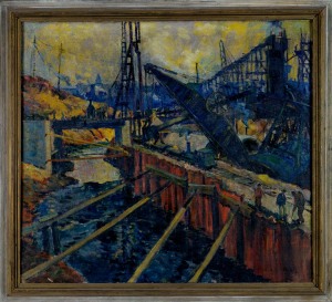
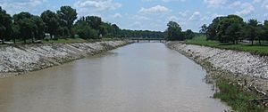
The United States Army Corps of Engineers, Horner & Shifrin, and the Works Progress Administration (WPA) led this big project. The lower sides of the river were lined with strong limestone. This created a unique and lasting landmark. You can even see "Safety First / W.P.A." written in mosaics along the eastern banks. Today, this southern part of the river has a sewer underneath it. It only fills with water when there are heavy rains.
In 1988, the American Society of Civil Engineers recognized the River des Peres project. They called it a National Historic Civil Engineering Landmark. This was because of the clever calculations, the way they removed water from trenches, and how they made the soil stable.
During the Great Flood of 1993, some of the worst flooding happened near where the River des Peres flows into the Mississippi River.
River des Peres: What It's Like Today
The River des Peres goes into underground tunnels north of Forest Park. It then comes out south of the park into concrete channels. Finally, it flows into the Mississippi River.
The Forest Park Water Feature
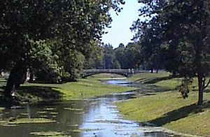
In Forest Park, there is a man-made water flow that looks like a river. It uses the city's water supply. Many people think this is the original River des Peres, but it's not. This water flow is made on purpose and does not come from rain or runoff. It was designed to look like a pretty river scene. This helped the park keep its original, natural look from the early 1900s.
Managing the River Today
The River des Peres is still part of the combined sewer and stormwater system. This system covers large parts of St. Louis City and County. The St. Louis Metropolitan Sewer District (MSD) manages it. They focus on handling sanitary and storm water. The United States Army Corps of Engineers also helps with flood control and safety.
The MSD is working to separate the sanitary and stormwater systems. This will help make the river safer and more fun for people to use for activities.
The River des Peres Greenway Project has created an 11-mile (17.7 km) park along the river. It stretches from Forest Park to the Mississippi. This project is part of a bigger plan called the River Ring project by The Great Rivers Greenway District.
 | Roy Wilkins |
 | John Lewis |
 | Linda Carol Brown |


