The Great Rivers Greenway District facts for kids
| Formation | November 2000 (26 years ago) |
|---|---|
| Legal status | Missouri Political Subdivision |
| Purpose | Develop a regional network of greenways |
| Headquarters | 3745 Foundry Way, Suite 253 |
| Location |
|
| Leader | Susan Trautman, CEO |
|
Main organ
|
Metropolitan Park and Recreation District, doing business as Great Rivers Greenway |
|
Budget
|
$25.5 million (2021) |
| Website | greatriversgreenway.org |
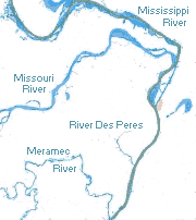
The Great Rivers Greenway District is a public group in Missouri. It works to create a big network of greenways, parks, and trails. These are all located in the St. Louis area. The group works with people and local partners. They plan, build, and take care of these greenways.
Contents
How the Greenways Began
Early Ideas for Greenways
In 1996, a non-profit group called St. Louis 2004 was formed. Its goal was to make the St. Louis region better by 2004. One of their main ideas was to build a network of greenways.
Voters Approve Greenways
In 2000, Peter Sortino, the group's president, helped get a plan on the local ballot. This plan asked voters to approve a small sales tax. This tax would help pay for greenway development. In November 2000, voters in St. Louis City, St. Louis County, and St. Charles County said "yes" to this plan. It was called Proposition C, or the Clean Water, Safe Parks and Community Trails Initiative. This tax then created The Great Rivers Greenway District.
Planning the River Ring
The Great Rivers Greenway District is guided by a board of directors. These members are chosen by leaders from the city and two counties. A CEO and staff work on a big plan called the River Ring. They work with many local and state groups.
In 2003, Great Rivers Greenway shared its plan, "Building the River Ring: A Citizen-Driven Regional Plan." This plan was made with ideas from citizens and many organizations. It aimed to create the River Ring, a system of over 40 greenways, parks, and trails. This system would cover more than 600 miles in the St. Louis area. It would also connect to trails in Illinois. The idea was to show off the natural beauty of the region's rivers. It also aimed to connect people to where the Mississippi and Missouri rivers meet.
Updating the Plan and Growth
Great Rivers Greenway updated its plan in 2011 and 2016. A new group, the Great Rivers Greenway Foundation, was also started. This foundation helps find private money for greenway projects. By 2020, the agency had built over 128 miles of greenways. These paths connect parks, rivers, schools, neighborhoods, and businesses. The agency continues to ask citizens for their ideas on how to build and care for the greenways.
Explore the Greenways
Here are some of the greenways in the district:
- Boschert Greenway: This greenway goes from New Town in St. Charles to the Missouri River near Historic Downtown St. Charles. It also connects to the Katy Trail. You can see a 30-foot flower sculpture called “Blomstre” here. It was made from old bicycle parts!
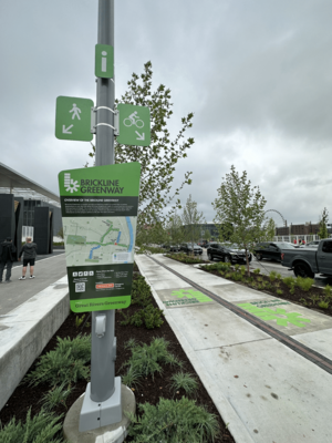
- Brickline Greenway: This greenway, once called the Chouteau Greenway, plans for 20 miles of trails and green spaces. It will connect 17 neighborhoods across the City of St. Louis. It will link Fairground Park in the north to Tower Grove Park in the south. It will also connect Forest Park in the west to Gateway Arch National Park in the east. The goal is to bring different communities together.
- Busch Greenway: The Busch Greenway in St. Charles County links the Katy Trail to Missouri Research Park. It also connects to the August A. Busch Memorial Conservation Area.
- Centennial Greenway: This greenway will stretch from Forest Park in St. Louis to St. Charles County. Parts of it are already finished. One section goes through the Washington University campus. Another part connects Shaw Park in Clayton to Olive Boulevard. A third section links the Katy Trail to the St. Charles Heritage Museum. It also crosses the Missouri River to Creve Coeur Lake Memorial Park.
- Dardenne Greenway: This greenway follows Dardenne Creek across St. Charles County. One part goes through the BaratHaven community and a restored prairie. Another part connects Legacy Park in Cottleville to St. Charles Community College and Dardenne Park.
- Deer Creek Greenway: The Deer Creek Greenway runs from Deer Creek Park in Maplewood to Lorraine Davis Park in Webster Groves.
- Fee Fee Greenway: This greenway extends from the Maryland Heights Recreation Complex to Creve Coeur Lake Memorial Park.
- Gravois Greenway: Grant's Trail: Grant's Trail follows Gravois Creek along an old railroad path. A group called Trailnet bought the path in 1991 and built the first six miles. Since 2006, Great Rivers Greenway has made the trail longer. It now reaches 10 miles from Kirkwood to the River des Peres Greenway. You can visit the Ulysses S. Grant National Historic Site, Grant's Farm, and the Thomas Sappington House Museum along this trail.
- Maline Greenway: The Maline Greenway connects to other paved trails in Bella Fontaine County Park. This is the first part of a planned seven-mile path. It will link the Mississippi and St. Vincent Greenways.
- Meramec Greenway: The plan for the Meramec River Greenway is a 50-mile path along the Meramec River. Parts of it are already done. One section connects Lions Park in Eureka to Route 66 State Park. Another part runs along the river on the Al Foster Trail. Other sections connect parks in Valley Park, Kirkwood, and Fenton.
- Mississippi Greenway: This greenway, once called the Confluence Greenway, is planned to be 32 miles long. It will connect with the Missouri, Maline, River des Peres, and Meramec Greenways. Three sections are built. The Riverfront Trail goes from downtown St. Louis north to the old Chain of Rocks Bridge. This bridge is one of the longest bike and walking bridges in the world! Another part connects Jefferson Barracks County Park with River City Casino. A third section goes through Cliff Cave County Park with views of the Mississippi River.
- Missouri Greenway: The plan for the Missouri Greenway is a 55-mile path along the Missouri River. It will connect with several other greenways. Three sections are built. One runs from Riverwoods Park in Bridgeton to the Discovery Bridge. Another part in Chesterfield runs along the Monarch Chesterfield Levee Trail. A third section in Hazelwood goes through Truman Park.
- River des Peres Greenway: The River des Peres Greenway plans for an 11-mile path from Forest Park to the Mississippi River. It currently runs from Francis R. Slay Park in St. Louis to Carondelet Park and Lemay Park. It also connects to the Gravois Greenway: Grant's Trail.
- St. Vincent Greenway: This greenway will be seven miles long. It will go from the North Hanley MetroLink station through the University of Missouri–St. Louis (UMSL) campus to Forest Park. Two sections are finished. The north part runs through the UMSL campus. The south part connects Trojan Park to Forest Park.
- Sunset Greenway: The Sunset Greenway in north St. Louis County runs from the Old St. Ferdinand Shrine in Florissant through St. Ferdinand Park to Sunset Park on the Missouri River.
- Western Greenway: The Western Greenway runs from the Meramec Greenway at Glencoe to Rockwoods Reservation. The plan is to extend it to connect with Babler State Park and the Missouri Greenway.
CityArchRiver Project
A New Look for the Arch Grounds
In 2007, many years after the Gateway Arch was built, the area around it felt separate from the rest of St. Louis. Busy highways cut it off from the city and the Mississippi River. Walter Metcalfe, a leader in St. Louis, helped start the CityArchRiver2015 Foundation in 2009. Their goal was to make the St. Louis Riverfront and Arch grounds much better.
In 2010, a New York company won a contest to redesign the Arch grounds. The project received a lot of money from different sources. This included $20 million from the U.S. Department of Transportation and $25 million from the Missouri Department of Transportation. Private donations also added $10 million. The total cost was $380 million, so more money was needed.
Working Together for Parks
Great Rivers Greenway joined this effort in 2012. They became part of a team with the CityArchRiver2015 Foundation and other groups. They planned a vote called Proposition P. This vote would create a sales tax to help pay for the CityArchRiver project and other park improvements.
In April 2013, voters in St. Louis City and St. Louis County approved Proposition P. This plan allowed for a small sales tax to fund the CityArchRiver project. It also helped speed up building local parks and greenways. This tax was expected to bring in $780 million over 20 years. 60 percent of this money went to Great Rivers Greenway. The other 40 percent supported local parks in St. Louis City and County. Half of Great Rivers Greenway's share went to the CityArchRiver project. The other half was used to build more greenways faster.
Great Rivers Greenway managed $85 million from Proposition P. This money helped complete several big projects over the next five years:
- The Park Over the Highway: This was a land bridge built over the I-44 and I-70 highways. It connected downtown St. Louis to the Arch grounds and the riverfront. This made it easy and safe for people to walk or bike through the area.
- Luther Ely Smith Square: This green space leading to the Park Over the Highway was updated.
- Riverfront Trail Extension: The Riverfront Trail on the Mississippi Greenway was made 1.5 miles longer. It now runs along Leonor K. Sullivan Boulevard. The boulevard itself was also raised to help with flooding.
- North Gateway: This new area at the north entrance to the Arch grounds opened for fun and events. It has a natural outdoor theater, paths for bikes and walkers, shaded lawns, and a children's garden. It also has a raised walkway with views of the Gateway Arch and the historic Eads Bridge.
- Arch Grounds Transformation: The Arch grounds were changed with new ponds, plants, and easy-to-use walkways. These paths connect the Gateway Arch to the Mississippi River.
- Kiener Plaza Redesign: Kiener Plaza was redesigned as a public gathering spot. It now has a playground, fountains, a splash pad, a grassy area for concerts, and bike parking.
- Gateway Arch National Park Museum: The museum and visitor center at Gateway Arch National Park were updated and made larger.
- Old Courthouse Renovation: Plans were made to update the Old Courthouse. This work was set to begin in late 2021 to make it better for visitors.
In 2017, the CityArchRiver Foundation changed its name to the Gateway Arch Park Foundation. This foundation raised $250 million in private money for the project.
 | Jackie Robinson |
 | Jack Johnson |
 | Althea Gibson |
 | Arthur Ashe |
 | Muhammad Ali |


