Cliff Cave County Park facts for kids
Quick facts for kids Cliff Cave County Park |
|
|---|---|
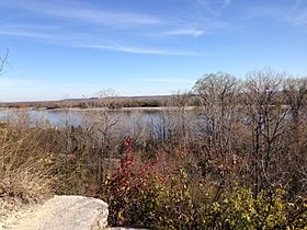
View of the Mississippi River from the bluffs
|
|
| Type | County Park |
| Location | 806 Cliff Cave Rd, St Louis, Missouri, United States |
| Area | 525 acres (2.12 km2) |
| Created | 1972 |
| Operated by | St. Louis County, Missouri |
| Website | http://www.stlouisco.com/ParksandRecreation/ParkPages/CliffCave |
Cliff Cave County Park is a huge 525-acre public park located in St. Louis, Missouri. It is managed by St. Louis County Parks. The park gets its name from Cliff Cave, a natural cave that is important for history and archaeology.
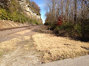
The park features woodlands, wetlands, and rocky hillsides. It sits right next to the famous Mississippi River. You can explore three main trails here: the Mississippi Trail, the Spring Valley Trail, and the River Bluff Trail. There's also a spot called the Riverside Shelter, which offers great views of the Mississippi River. An active train track runs through the park. Cliff Cave Park is part of the Mississippi River Greenway. In 2009, it won an award for the "Best View of the Mississippi" from The Riverfront Times.
Contents
Park History
Long ago, Native Americans were drawn to this area. They liked the cave, fresh spring water, and the nearby Mississippi River. They believed the cave was a special, sacred place.
In 1749, a man named Jean Baptiste Gamache first got the land. This was through a land grant from the Spanish government.
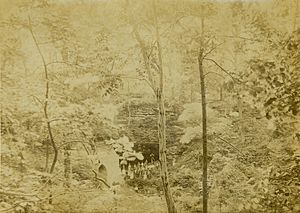
In the 1770s, French fur trappers and traders used Cliff Cave. It was a riverside tavern for people traveling on the Mississippi River.
In 1854, Christopher W. Spalding and Henry W. Williams bought the area. They later divided the land into smaller lots in 1857.
During the Civil War in the 1860s, some people thought Confederate soldiers used the cave. It was believed to be a secret meeting spot for them.
Wine and Beer Storage
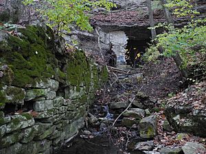
After the Civil War, Missouri became a big center for winemaking. In 1866, the Cliff Cave Wine Company started. In 1868, they bought the area for over $36,000. They used the cave as a natural wine cellar. The company planted 25 acres of grapes. These grapes produced 3,000 gallons of wine in just one year! By 1870, the cave could store 100,000 gallons of wine. You can still see some of the stonework they built near the cave entrance today.
Around 1910, the cave was rented to Anheuser-Busch. This company used it to store beer. They would collect ice from the river in winter. This ice helped keep the beer cool during the summer months.
Park Opening
In 1969, St. Louis County decided to buy the Cliff Cave property. The land was worth $400,000. Money from the Land and Water Conservation Fund helped with the purchase. The land was officially bought in the fall of 1972. Finally, in the spring of 1977, Cliff Cave Park opened to the public.
In 1986, people voted to make the park a Natural Heritage Park. This means that only a small part (five percent) of the park can have new buildings or development. This helps protect its natural beauty.
Park Features
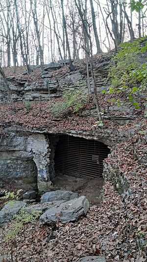
Cliff Cave
Cliff Cave is also known as Indian Cave. It is the second longest cave in St. Louis County. It has 4723 feet (1514 meters) of passages that have been explored. The cave is found at the start of a ravine, with a stream flowing out of its entrance. It formed in St. Louis limestone from the Mississippian Period. The cave stays at a cool 57 °F (14 °C) all year round.
The cave formed because of a karst plateau in the area. Over time, water dissolved the dolomite and limestone bedrock. This created many sinkholes. The cave is connected to some of these sinkholes. This means the cave can sometimes have flash floods.
In October 2009, a special cave gate was put at the entrance. This gate helps protect the endangered Indiana bat that lives in the cave. Many groups worked together on this project. Since the gate was installed, the number of bats living there has grown! Other animals in the cave include big brown bats, little brown bats, eastern pipistrelles, cave salamanders, and isopods.
Mississippi Trail
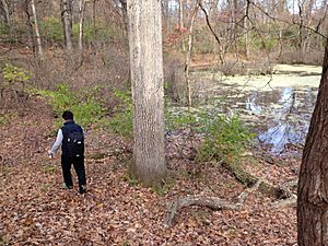
The Mississippi Trail is a 5.1-mile loop. It is flat and paved, perfect for hikers and bikers. This trail is in the floodplain bottoms. It goes through woodlands and wetlands. Sometimes, the Mississippi River can flood this trail.
You'll see wild grasses and wildflowers here. Trees like silver maple, sycamore, cottonwood, black willow, and box elder grow along the trail. Animals you might spot include beavers, migrating waterfowl, great blue herons, and egrets.
Spring Valley Trail
The Spring Valley Trail is a 3-mile natural path. It's great for horseback riders, hikers, and mountain bikers. You can reach Cliff Cave from this trail. The trail goes up a valley and then loops through the woodlands on a karst plateau. You'll find hickory and oak trees along this trail.
River Bluff Trail
The River Bluff Trail is a 1-mile flat, natural path. It's also open to horseback riders, hikers, and mountain bikers. This trail gives you amazing views of the Mississippi River from the bluffs.
You'll see prairie grasses like native side-oats grama and little bluestem. There are also wildflowers and chinkapin oak trees. Unfortunately, some plants like honeysuckle are invasive and threaten the native plants here.
 | Georgia Louise Harris Brown |
 | Julian Abele |
 | Norma Merrick Sklarek |
 | William Sidney Pittman |


