Roaring Fork (Great Smoky Mountains) facts for kids
Quick facts for kids |
|
|
Roaring Fork Historic District
|
|
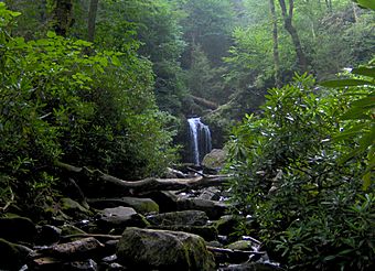
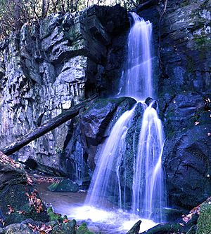
Roaring Fork, with Grotto Falls in the distance
|
|
| Location | GSMNP |
|---|---|
| Nearest city | Gatlinburg, Tennessee |
| Built | 1880 |
| NRHP reference No. | 76000170 |
| Added to NRHP | March 16, 1976 |
Roaring Fork is a lively stream found in the beautiful Great Smoky Mountains of Tennessee, in the southeastern United States. Long ago, a small community lived here. Today, the area is famous for the Roaring Fork Motor Nature Trail and the Roaring Fork Historic District.
This mountain stream is quite special. Most days, it flows gently like a peaceful trickle. But after a good rain, it quickly turns into a powerful, rushing river! The loud sound of the water is why it's called "Roaring Fork." The sound gets even louder because it echoes off the nearby mountains.
Contents
Exploring Roaring Fork's Geography
The Roaring Fork stream begins high up on Mount Le Conte. Several small springs come together to form its source. The highest of these springs, called Basin Spring, even supplies water to LeConte Lodge.
From its start, Roaring Fork drops about 2,500 feet (762 meters) in just two miles (3 km). It flows over Grotto Falls and joins with Surry Creek. Then, it settles into a narrow valley between Mount Winnesoka and Piney Mountain. Roaring Fork ends in the northern part of Gatlinburg. Here, it flows into the West Fork of the Little Pigeon River.
The Rocks of Roaring Fork
The Roaring Fork valley sits on ancient sandstone rocks. These rocks formed from old ocean sediments almost a billion years ago. You can find these "Roaring Fork Sandstone" rocks all over the northern Smokies.
Over thousands of years, water and weather have carried large sandstone boulders down from the mountains. This has left the stream bed and valley flats covered with rocks of all sizes. Early farmers in the area were always moving and stacking these rocks. This is why you can still see many rock walls crisscrossing the land today.
Discovering the Roaring Fork Historic District
Around 1800, the first European-American settlers arrived in the White Oak Flats area, which is now Gatlinburg. Their children and grandchildren then moved into the nearby valleys. Richard Reagan (1776–1829) was one of these early pioneers. His family settled along Roaring Fork, in a place then called "Spruce Flats."
By 1900, three of Richard Reagan's grandsons, Alfred Reagan, Aaron Reagan, and John H. Reagan, were still farming along the stream.
The Bales Family Farms
The Bales family settled in the upper part of Roaring Fork around the 1830s. Caleb Bales (1839–1913) owned a farm just south of the Reagan lands. His sons, Jim Bales (1869–1939) and Ephraim Bales (1867–1936), spent most of their lives farming the land they inherited.
The Bales and Reagan families often married each other. For example, Caleb Bales married Elizabeth, one of Richard Reagan's granddaughters.
Other families, like the Clabo family, Gilbert Ogle, and Jasper Mellinger, also had farms further up Roaring Fork. You can often spot old farm sites by looking for young tuliptrees. These trees grow quickly on land that was once farmed.
Around 1850, the people of Roaring Fork built a simple road to connect their community to White Oak Flats. By 1900, the area had grown into a small mountain village. It had its own school, church, general store, and mills for grinding grain.
In 1976, the Roaring Fork Historic District was officially recognized. It was added to the National Register of Historic Places.
The Jim Bales Place
The Jim Bales Place is the first historic stop on the Roaring Fork Motor Nature Trail. Jim Bales inherited this farm from his father, Caleb. Jim, whose full name was James Wesley Bales, lived here for most of his life.
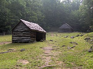
When the Park Service took over the land in the 1930s, a more modern house on the farm was removed. The Alex Cole Cabin, which shows what pioneer homes were like, was moved here from another area called the Sugarlands. Jim Bales's corn crib and barn are still standing today.
The Ephraim Bales Place
Just below the Jim Bales Place is the farm of Ephraim and Minerva Bales. Ephraim, Jim Bales's older brother, farmed about 30 acres (12 hectares) of his 70-acre (28-hectare) property. The rest was mostly woods, which the family used for building and firewood.
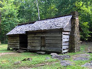
The Bales cabin was a "double cabin" with a passageway in the middle called a "dog trot." These cabins have two parts with a space of about 10 feet (3 meters) between them, all under one roof. This space was cool in summer and warm in winter. Both sides of the cabin have their own chimney. The cabin looks much like it did when the Bales family lived there in the early 1900s.
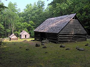
Near the cabin, you can still see Bales's corn crib, hog pen, and barn. A rock wall and a wooden fence behind the cabin show the types of barriers used in the Smokies long ago.
The Alfred Reagan Place
Alfred Reagan, whose family were among the first settlers, owned a small farm below the Ephraim Bales Place. Alfred was very skilled and did many jobs for the community. He ran the blacksmith shop, the general store, and the most reliable grist mill in Roaring Fork. He was also a part-time preacher at the Roaring Fork Church. He even gave the land for the church and helped build it.
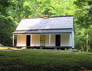
Today, only Alfred Reagan's cabin and mill remain on his farm. His cabin stands out because it has sawboard paneling and a coat of paint. It's a "saddlebag" design, meaning two cabins built around a single chimney. A kitchen was added later.
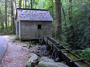
Reagan's mill is a standard tub mill. A channel redirects water from Roaring Fork to power a turbine. This turbine turns a grindstone that grinds corn and wheat into cornmeal and flour. Reagan's mill was very well-built. People say it could still operate even when other mills didn't have enough water.
The Alex Cole Cabin
The Alex Cole Cabin is the last building left from the Sugarlands community. It was built by a mountain guide named Albert Alexander Cole. The cabin was moved from its original spot to the Jim Bales Place along the Roaring Fork Motor Nature Trail.
Driving the Roaring Fork Motor Nature Trail
The Roaring Fork Motor Nature Trail is a narrow, one-way road. It's open to cars and small pickup trucks in the spring, summer, and fall. Besides the historic district, the road offers beautiful views and passes through a forest typical of the mid-level Smokies.
The trail starts near the Rainbow Falls Trailhead. It slowly climbs Piney Mountain, reaching an overlook about 3,000 feet (914 meters) high. Just past this spot, you'll see many large chestnut trees that fell down. These huge trees, some 5–6 feet (1.5–1.8 meters) wide, were killed by a disease in the 1930s.
As the road goes down Piney Mountain, it passes a parking lot for the Trillium Gap Trail. This hiking trail leads past Grotto Falls and Trillium Gap. It continues all the way to the top of Mount Le Conte. Trillium Gap was named by Horace Albright in the 1920s because he saw many trillium flowers there.
After the Trillium Gap Trailhead, the road becomes flatter as it enters the upper part of the Roaring Fork hollow. Patches of young tuliptrees show where the old Clabo and Ogle farms used to be. After crossing Roaring Fork, you'll see the Jim Bales Place on your right. The Grapeyard Ridge Trail, which connects Roaring Fork to Greenbrier, starts behind the barn. Further on are the Ephraim Bales Place and the Alfred Reagan Place.
The road continues downhill past the historic district. It passes a parking lot where you can get a close look at Roaring Fork. A thin waterfall called "The Place of a Thousand Drips" is the last stop. After that, the motor trail ends back in Gatlinburg.
 | Madam C. J. Walker |
 | Janet Emerson Bashen |
 | Annie Turnbo Malone |
 | Maggie L. Walker |


