Rock Island Trail State Park (Missouri) facts for kids
Quick facts for kids Rock Island Spur of Katy Trail State Park |
|
|---|---|

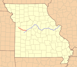
Location of the Rock Island Trail in red and the Katy Trail in blue
|
|
| Length | 47.5 mi (76.4 km) |
| Location | Missouri, United States |
| Trailheads | Windsor, Leeton, Chilhowee, Medford, Pleasant Hill |
| Use | Hiking, Cycling, Horseback |
| Elevation change | negligible |
| Difficulty | Easy |
| Season | All |
| Hazards | Severe weather Poison ivy Snakes |
| Website | Rock Island Spur |
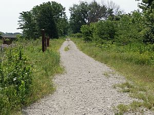
The Rock Island Spur of Katy Trail State Park is a special kind of state park in Missouri, USA. It's a 47-mile (76 km) long trail for hiking and biking. This trail was once a railroad line. It opened on December 10, 2016.
This trail connects the Kansas City area to the 240 mi (390 km) Katy Trail State Park. The Katy Trail is the longest "rails-to-trails" path in the United States. The Rock Island Trail uses old railroad tracks from the Chicago, Rock Island and Pacific Railroad. It runs between Pleasant Hill and Windsor. In Windsor, it meets the Katy Trail.
There are plans to make the Rock Island Trail even longer. About 144 miles (232 km) of old railroad land might be added. This would extend the trail from Windsor all the way to Beaufort. If this happens, the Rock Island and Katy trails together would be about 450 miles (720 kilometres) long! This would create a huge network of trails for everyone to enjoy.
In May 2016, Jackson County, Missouri, bought 17.7 miles (28.5 km) of old railroad land. This section goes from the Truman Sports Complex into the southern part of Lee's Summit. Work on this part began in 2017, and the first half opened in 2018. There is still a small gap between Lee's Summit/Greenwood and Pleasant Hill. The exact path for this missing section is still being decided.
Exploring the Trail's Path
The Rock Island Spur begins in Windsor, Missouri. Its starting point is marked as mile 216.5. From Windsor, the trail heads northwest. It goes through Johnson County. The trail ends in Pleasant Hill, Missouri, at mile 262.9.
Trailhead Locations
Here are the main places where you can start or stop your journey on the trail:
| Trailhead Town | Mile-Marker |
|---|---|
| Windsor | 216.5 |
| Leeton | 227 |
| Chilhowee | 235.6 |
| Medford | 245.4 |
| Pleasant Hill | 262.9 |
 | Sharif Bey |
 | Hale Woodruff |
 | Richmond Barthé |
 | Purvis Young |


