Chilhowee, Missouri facts for kids
Quick facts for kids
Chilhowee, Missouri
|
|
|---|---|
 |
|

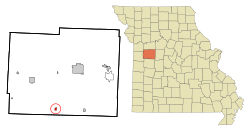
Location of Chilhowee, Missouri
|
|
| Country | United States |
| State | Missouri |
| County | Johnson |
| Area | |
| • Total | 0.36 sq mi (0.93 km2) |
| • Land | 0.36 sq mi (0.93 km2) |
| • Water | 0.00 sq mi (0.00 km2) |
| Elevation | 922 ft (281 m) |
| Population
(2020)
|
|
| • Total | 291 |
| • Density | 806.09/sq mi (311.64/km2) |
| Time zone | UTC-6 (Central (CST)) |
| • Summer (DST) | UTC-5 (CDT) |
| ZIP code |
64733
|
| Area code(s) | 660 |
| FIPS code | 29-13654 |
| GNIS feature ID | 0729719 |
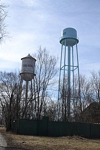
Chilhowee is a small village located in south central Johnson County, Missouri, in the United States. It is situated along Missouri Route 2. In 2020, about 291 people lived there.
Contents
History of Chilhowee
Chilhowee was first known as Simpson's Store. It was founded in the mid-1850s. The village was named after James Simpson, who was a local merchant.
A post office opened in Chilhowee in 1859. The name "Chilhowee" comes from a Native American language.
The Chilhowee Historic District is a special area in the village. It was added to the National Register of Historic Places in 1988. This means it's recognized as an important historical site.
Geography and Location
Chilhowee is located on Missouri Route 2. It is about two miles west of Post Oak and Missouri Route 13.
Old Chilhowee is one mile north on Missouri Route F. Denton is four miles northwest on Route 2. The village sits on a high area between two creek systems. These are Post Oak Creek to the north and Big Creek to the south.
According to the United States Census Bureau, the village covers a total area of about 0.38 square miles (0.93 square kilometers). All of this area is land.
Population and People
The population of Chilhowee has changed over the years. Here's a look at how many people have lived there during different census counts:
| Historical population | |||
|---|---|---|---|
| Census | Pop. | %± | |
| 1870 | 185 | — | |
| 1880 | 86 | −53.5% | |
| 1910 | 425 | — | |
| 1920 | 469 | 10.4% | |
| 1930 | 414 | −11.7% | |
| 1940 | 415 | 0.2% | |
| 1950 | 335 | −19.3% | |
| 1960 | 339 | 1.2% | |
| 1970 | 297 | −12.4% | |
| 1980 | 349 | 17.5% | |
| 1990 | 335 | −4.0% | |
| 2000 | 329 | −1.8% | |
| 2010 | 325 | −1.2% | |
| 2020 | 291 | −10.5% | |
| U.S. Decennial Census | |||
Chilhowee Population in 2010
In 2010, the village had 325 people. There were 129 households, which are groups of people living together. Out of these, 85 were families.
The village had about 855 people per square mile. There were 163 housing units in total. Most residents, about 95.4%, were White. A small number were Native American or from two or more races. About 1.2% of the population was Hispanic or Latino.
Many households, 36.4%, had children under 18 living with them. About 42.6% were married couples. The average household had 2.52 people. The average family had 3.02 people.
The average age of people in Chilhowee was 35.1 years. About 29.8% of residents were under 18. About 15.4% were 65 years old or older. The population was almost evenly split between males (50.5%) and females (49.5%).
Things to See and Do
- Rock Island Spur Trailhead: This is a popular spot for outdoor activities.
See also
 In Spanish: Chilhowee (Misuri) para niños
 | Calvin Brent |
 | Walter T. Bailey |
 | Martha Cassell Thompson |
 | Alberta Jeannette Cassell |

