Rockford, Washington facts for kids
Quick facts for kids
Rockford, Washington
|
|
|---|---|

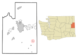
Location of Rockford, Washington
|
|
| Country | United States |
| State | Washington |
| County | Spokane |
| Area | |
| • Total | 0.66 sq mi (1.72 km2) |
| • Land | 0.66 sq mi (1.72 km2) |
| • Water | 0.00 sq mi (0.00 km2) |
| Elevation | 2,388 ft (728 m) |
| Population
(2020)
|
|
| • Total | 522 |
| • Density | 791/sq mi (303.5/km2) |
| Time zone | UTC-8 (Pacific (PST)) |
| • Summer (DST) | UTC-7 (PDT) |
| ZIP code |
99030
|
| Area code | 509 |
| FIPS code | 53-59145 |
| GNIS feature ID | 1507868 |
Rockford is a small town located in Spokane County, Washington, in the United States. In 2020, about 522 people lived there. It is a quiet community in the eastern part of Washington state.
Contents
History of Rockford: How It Began
Rockford was first settled in 1878 by a person named D.C. Farnsworth. The town got its name from a "rocky ford" (a shallow place to cross a river) on Rock Creek. Rockford officially became a town in 1890.
Geography: Where Is Rockford Located?
Rockford is found at coordinates 47°27′3″N 117°7′58″W / 47.45083°N 117.13278°W. This means it is in the northern hemisphere, west of the prime meridian.
The town covers a total area of about 0.68 square miles (1.72 square kilometers). All of this area is land, with no large bodies of water inside the town limits.
Population Changes: How Has Rockford Grown?
The population of Rockford has changed quite a bit over the years. Here's a look at how many people have lived in the town since 1890:
| Historical population | |||
|---|---|---|---|
| Census | Pop. | %± | |
| 1890 | 644 | — | |
| 1900 | 433 | −32.8% | |
| 1910 | 663 | 53.1% | |
| 1920 | 435 | −34.4% | |
| 1930 | 381 | −12.4% | |
| 1940 | 130 | −65.9% | |
| 1950 | 152 | 16.9% | |
| 1960 | 369 | 142.8% | |
| 1970 | 327 | −11.4% | |
| 1980 | 442 | 35.2% | |
| 1990 | 481 | 8.8% | |
| 2000 | 413 | −14.1% | |
| 2010 | 470 | 13.8% | |
| 2020 | 522 | 11.1% | |
| U.S. Decennial Census | |||
What Was Rockford Like in 2010?
In 2010, about 470 people lived in Rockford. There were 192 households, which are groups of people living together. Most of these households (136) were families.
The town had about 691 people per square mile. Most residents (92.6%) were White. There were also people who identified as African American, Native American, and Asian. About 3% of the population was Hispanic or Latino.
Many households (27.1%) had children under 18 living with them. Most households (57.3%) were married couples. The average household had 2.45 people, and the average family had 2.78 people.
The average age in Rockford in 2010 was 44.9 years old. About 19.4% of residents were under 18. About 16.2% were 65 years or older. The town had a nearly even number of males (50.2%) and females (49.8%).
See also

- In Spanish: Rockford (Washington) para niños
 | Leon Lynch |
 | Milton P. Webster |
 | Ferdinand Smith |

