Roof Butte facts for kids
Quick facts for kids Roof Butte |
|
|---|---|
| Highest point | |
| Elevation | 9,787 ft (2,983 m) NAVD 88 |
| Prominence | 3,140 ft (960 m) |
| Geography | |
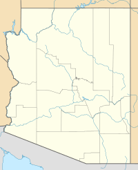
| Location | Navajo Nation, Apache County, Arizona, U.S. |
| Parent range | Chuska Mountains |
| Topo map | USGS Roof Butte |
| Climbing | |
| Easiest route | Indian Route 68 |
Roof Butte is a special peak located in the Chuska Mountains in Arizona, United States. Its name in the Navajo language is Navajo: Adáá dikʼá, which means "Roof shaped mountain on the run." This mountain is the highest point in the entire Chuska Mountains range.
The Chuska Mountains stretch from north to south across the border between Arizona and New Mexico. Roof Butte stands out because it looks like a flat-topped hill, which is called a butte. You can see it from many miles away!
What is Roof Butte?
Roof Butte is a tall landform that reaches an elevation of 9,787 feet (2,983 m) above sea level. It is a very important landmark in the area.
A Special Lookout Point
At the very top of Roof Butte, there is a special tower. This tower is used by people who watch for forest fires. It helps them keep the surrounding forests safe.
How Roof Butte Formed
The flat top of Roof Butte was created by ancient volcanic activity. Long ago, two funnel-shaped areas called volcanic pipes formed on the mountain. These pipes were like pathways for hot rock and gas from deep inside the Earth.
A smaller, rounded hill called a lava dome also sits near the main peak. These features show that Roof Butte has a fiery past!
Visiting Roof Butte
Roof Butte is located within the Navajo Nation. If you want to visit this area, you need to get a special permit. This helps protect the land and respect the local community. The easiest way to get close to the butte is by using Indian Route 68.
 | Dorothy Vaughan |
 | Charles Henry Turner |
 | Hildrus Poindexter |
 | Henry Cecil McBay |


