Rubió facts for kids
Quick facts for kids
Rubió
|
|||
|---|---|---|---|
|
Municipality
|
|||
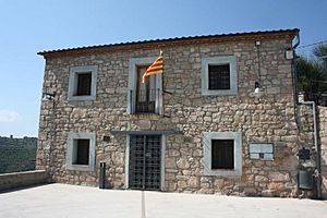
Rubió town hall
|
|||
|
|||
| Country | Spain | ||
| Community | |||
| Province | |||
| Comarca | Anoia | ||
| Area | |||
| • Total | 48.0 km2 (18.5 sq mi) | ||
| Elevation | 634.4 m (2,081.4 ft) | ||
| Population
(2018)
|
|||
| • Total | 232 | ||
| • Density | 4.833/km2 (12.52/sq mi) | ||
Rubió is a small, quiet town in the Anoia area of Catalonia, Spain. It's known as a rural municipality, which means it's a local government area. The main village is Rubió itself, but it also includes other villages like Maçana and El Pla de Rubió.
As of 2018, about 232 people live in Rubió. It covers an area of 48 square kilometers (about 18.5 square miles). This makes it one of the biggest towns in the Alta Segarra region by size, even though it has a small population.
Contents
About Rubió
In 1840, the area of Maçana joined with Rubió. This helped increase the population of the combined area. The borders of the town have stayed the same since then.
There are two main ideas about where the name Rubió comes from. One idea is that it comes from the Latin word rubeus, which means "coppery" or "reddish." This might refer to the red color of the land and rocks around the Castell de Rubió (Rubió Castle). The second idea is that it comes from the Latin word rufus, meaning "blond." This could be linked to a local landowner from the Roman Empire named Rubione.
Rubió's Coat of Arms
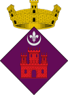
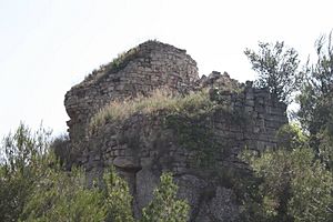
The coat of arms for Rubió was officially given on February 12, 1996. It shows a red castle at the bottom with a fleur-de-lis (a lily flower symbol) in the middle. At the top, there's a special crown called a mural crown, which represents a village. The castle on the coat of arms stands for the old, ruined Castell de Rubió.
Local Churches
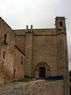
Rubió is part of the Vic diocese, which is a church district. The area has five churches:
- Santa Anna Chapel in Maçana, built in the 15th century.
- Santa Maria de Rubió Church in Rubió, built in 1275.
- Sant Martí de Maçana Church in Maçana, built in the 10th century.
- Sant Pere d'Ardesa Church in Rubió, built in the 11th century.
- Sant Macari Church in El Pla de Rubió, built in 1198.
Exploring Rubió's Geography
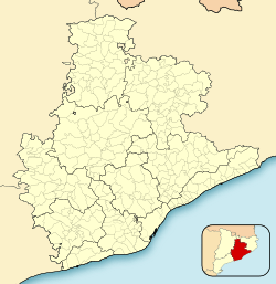
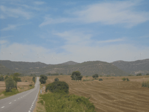
Rubió is located in the northeast part of the Anoia region. It's also close to the very center of Catalonia. The town shares its borders with other towns like Aguilar de Segarra, Castellfollit del Boix, Òdena, Jorba, Copons, and Els Prats de Rei. Rubió is right in the middle of the Serra de Rubió mountains. The highest point in these mountains is the Còpia de Palomes, which is 837 meters (2,746 feet) tall.
North of the Serra de Rubió mountains, you'll find the Maçana River. This river flows into the Llobregat River. The Rubió River, which also flows into the Llobregat, starts south of the mountains.
Wildlife and Forests
About 70% of Rubió is covered in forests. The most common trees you'll see are the Aleppo pine (Pinus halepensis), the Black pine (Pinus nigra), and the Scots Pine (Pinus sylvestris).
You can also find many animals living here, such as:
- Boar (Sus scrofa)
- European rabbit (Oryctolagus cuniculus)
- Deer (Cervus elaphus and Capreolus capreolus)
There are also many Falcons flying around.
Rubió's Climate
Rubió has a continental climate, which means it has very hot summers and cold winters. In summer, temperatures can go above 35°C (95°F), while in winter they can drop to -10°C (14°F). Snow, frost, and fog are common in winter. Sometimes, there isn't much rain in summer, and dry periods can last for two months. Spring and fall usually have more rain. On average, Rubió gets about 680 millimeters (26.8 inches) of rain each year.
| Month | Jan | Feb | Mar | Apr | May | Jun | Jul | Aug | Sep | Oct | Nov | Dec | year |
|---|---|---|---|---|---|---|---|---|---|---|---|---|---|
| Average temperature (°C) | 3,8 | 3,2 | 4,6 | 11,4 | 17,1 | 22,6 | 23,6 | 25,1 | 19,4 | 15,2 | 9,6 | 6.0 | 13,4 |
| Rainfall (mm) | 36 | 38 | 57 | 58 | 78 | 65 | 36 | 60 | 76 | 70 | 56 | 50 | 680 |
Rubió's Wind Farm
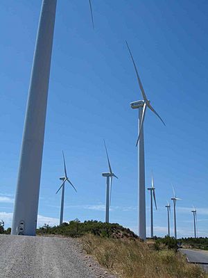
Rubió is home to Catalonia's largest wind farm. It has 50 huge windmills that create electricity. These windmills can produce enough energy to power 30,000 homes! The wind farm was built in late 2004 and started working in spring 2005. It provides power to Rubió and parts of Castellfollit del Boix and Òdena.
A Look at Rubió's History
People have lived in the Rubió area since the Copper Age, which was thousands of years ago. Archeologists have found an ancient burial site from that time and also a Roman village.
In the 14th century, Rubió faced tough times because of the plague and bad harvests. Many people left the village to find work in bigger cities and other towns. Later, in the early 1800s, during the Peninsular War, the Serra de Rubió mountains were an important spot for the local resistance fighters from Igualada.
Population and Transport
In 2014, Rubió had 220 residents, making it one of the least populated towns in Anoia. Most people who live there are seasonal, meaning they might only live there part of the year, and many work in agriculture.
You can reach Rubió by car using roads like the C-1412, BV-1031, BV-1037, and the A-2 motorway. However, there isn't any public bus service directly to the town. The closest bus station is in Jorba.
See also
 In Spanish: Rubió para niños
 | Roy Wilkins |
 | John Lewis |
 | Linda Carol Brown |


