Rushville, Ohio facts for kids
Quick facts for kids
Rushville, Ohio
|
|
|---|---|
|
Village
|
|

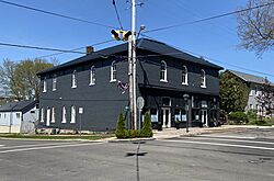
Downtown Rushville Ohio
|
|

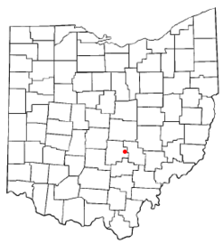
Location of Rushville, Ohio
|
|

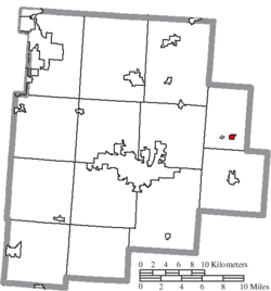
Location of Rushville in Fairfield County
|
|
| Country | United States |
| State | Ohio |
| County | Fairfield |
| Area | |
| • Total | 0.24 sq mi (0.62 km2) |
| • Land | 0.24 sq mi (0.62 km2) |
| • Water | 0.00 sq mi (0.00 km2) |
| Elevation | 1,056 ft (322 m) |
| Population
(2020)
|
|
| • Total | 304 |
| • Density | 1,266.67/sq mi (488.25/km2) |
| Time zone | UTC-5 (Eastern (EST)) |
| • Summer (DST) | UTC-4 (EDT) |
| ZIP codes |
43150
|
| Area code(s) | 740 |
| FIPS code | 39-69204 |
| GNIS feature ID | 2399144 |
Rushville is a small village located in Fairfield County, Ohio, in the United States. In 2020, about 304 people lived there. Many parts of the village are so old and important that they are listed as the Rushville Historic District on the National Register of Historic Places. This means they are protected because of their history.
Contents
History of Rushville Village
Rushville got its name from a nearby stream called Little Rush Creek. This creek flows between Rushville and another village, West Rushville. Joseph Turner founded the village in 1808. It became a busy and successful stop along an old road called Zane's Trace. This road was built in 1797 by a person named Colonel Ebenezer Zane.
Before the American Civil War, Rushville was an important stop on the Underground Railroad. This was a secret network that helped enslaved people escape to freedom. Several people who were seeking freedom died in Rushville and are buried in the nearby Pleasant Hill Cemetery.
Geography of Rushville
According to the United States Census Bureau, the village covers a total area of about 0.24 square miles (0.62 square kilometers). All of this area is land.
People Living in Rushville
| Historical population | |||
|---|---|---|---|
| Census | Pop. | %± | |
| 1870 | 221 | — | |
| 1880 | 227 | 2.7% | |
| 1890 | 291 | 28.2% | |
| 1900 | 257 | −11.7% | |
| 1910 | 246 | −4.3% | |
| 1920 | 209 | −15.0% | |
| 1930 | 201 | −3.8% | |
| 1940 | 228 | 13.4% | |
| 1950 | 252 | 10.5% | |
| 1960 | 283 | 12.3% | |
| 1970 | 289 | 2.1% | |
| 1980 | 299 | 3.5% | |
| 1990 | 229 | −23.4% | |
| 2000 | 268 | 17.0% | |
| 2010 | 302 | 12.7% | |
| 2020 | 304 | 0.7% | |
| U.S. Decennial Census | |||
Rushville's Population in 2010
In 2010, the village had 302 people living in 107 households. About 81 of these were families. The village had about 1258 people per square mile. Most of the people living in Rushville were White (96.0%). A small number were Asian (0.7%), and 3.3% were from two or more racial backgrounds.
Many households (44.9%) had children under 18 living with them. About 52.3% were married couples. The average household had 2.82 people, and the average family had 3.12 people.
The average age of people in the village was 32.3 years. About 30.5% of residents were under 18. About 5.3% were 65 years old or older. The village had slightly more females (52.6%) than males (47.4%).
Famous People from Rushville
- Benjamin Hanby was an abolitionist and a composer. An abolitionist was someone who worked to end slavery. He wrote the famous Christmas song "Up on the House Top". He also wrote a popular anti-slavery song called "Nelly Gray (song)".
See also
 In Spanish: Rushville (Ohio) para niños
 | Lonnie Johnson |
 | Granville Woods |
 | Lewis Howard Latimer |
 | James West |

