
Sabana, Luquillo, Puerto Rico facts for kids
Quick facts for kids
Sabana
|
|
|---|---|
|
Barrio
|
|

Sign at entrance of Sabana barrio
|
|

Location of Sabana within the municipality of Luquillo shown in red
|
|
| Lua error in Module:Location_map at line 416: Malformed coordinates value. | |
| Commonwealth | |
| Municipality | |
| Area | |
| • Total | 7.77 sq mi (20.1 km2) |
| • Land | 7.76 sq mi (20.1 km2) |
| • Water | 0.01 sq mi (0.03 km2) |
| Elevation | 705 ft (215 m) |
| Population
(2010)
|
|
| • Total | 2,352 |
| • Density | 303.1/sq mi (117.0/km2) |
| Source: 2010 Census | |
| Time zone | UTC−4 (AST) |
Sabana is a special type of neighborhood called a barrio in the town of Luquillo, Puerto Rico. In 2010, about 2,352 people lived there. It is a part of the beautiful island of Puerto Rico, which is a commonwealth of the United States.
History of Sabana
Puerto Rico was once controlled by Spain. After the Spanish–American War in 1898, Spain gave Puerto Rico to the United States. This happened because of a special agreement called the Treaty of Paris of 1898.
After this, Puerto Rico became a territory of the United States. In 1899, the United States government counted all the people living in Puerto Rico. This count is called a census. The census found that Sabana and a nearby barrio called Juan Martín had a combined population of 1,029 people.
| Historical population | |||
|---|---|---|---|
| Census | Pop. | %± | |
| 1980 | 1,350 | — | |
| 1990 | 2,448 | 81.3% | |
| 2000 | 2,292 | −6.4% | |
| 2010 | 2,352 | 2.6% | |
| U.S. Decennial Census 1899 (shown as 1900) 1910-1930 1930-1950 1980-2000 2010 |
|||
Pictures of Sabana
-
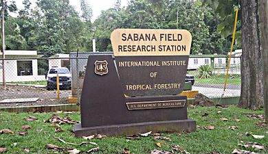
The Sabana Field Research Station is an entrance to the El Yunque National Forest.
-
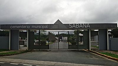
A cemetery located in the Sabana barrio.


Find Out More
 In Spanish: Sabana (Luquillo) para niños
- List of communities in Puerto Rico
