Saddleback Mountain (Piscataquis County, Maine) facts for kids
Quick facts for kids Saddleback Mountain |
|
|---|---|

Saddleback Mountain, seen from South Twin Lake, 15 miles (25 km) to the northeast
|
|
| Highest point | |
| Elevation | 2,999 ft (914 m) |
| Prominence | 1,854 ft (565 m) |
| Listing | 48 New England Fifty Finest |
| Geography | |
| Topo map | USGS Big Shanty Mountain |
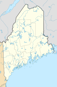
Saddleback Mountain is a mountain located in Piscataquis County, Maine. It is a notable peak in the eastern United States. The mountain is known for its unique shape, which looks a bit like a saddle.
About Saddleback Mountain
Saddleback Mountain stands tall in Maine. It reaches an elevation of 2,999 feet (914 meters). This makes it one of the higher points in the area. The mountain is part of the beautiful landscape of Piscataquis County.
Where the Water Goes
Water from Saddleback Mountain flows into many streams and rivers. All this water eventually reaches the Penobscot River. From there, it travels to Penobscot Bay and then into the ocean.
Different parts of the mountain send water in different directions:
- Water from the northeast side flows into Crater Pond. It then goes into the East Branch of the Pleasant River.
- The eastern part of the mountain drains into Mud Gauntlet Brook. This water also joins the East Branch of the Pleasant River.
- The southeast side sends its water into the Middle Branch of the Pleasant River.
- Water from the southwest side flows into Saddleback Brook. This leads to Silver Lake and then the West Branch of the Pleasant River.
- The northwest side of the mountain also drains into Silver Lake.
A Long View
Saddleback Mountain offers an amazing view. It is at one end of a very long line of sight. This means you can see a huge distance from its peak. The other end of this line is Mount Washington in New Hampshire. Mount Washington is about 136 miles (219 kilometers) away! This is one of the longest clear views between two high points in the eastern United States.
 | Georgia Louise Harris Brown |
 | Julian Abele |
 | Norma Merrick Sklarek |
 | William Sidney Pittman |


