South Twin Lake (Maine) facts for kids
Quick facts for kids South Twin Lake |
|
|---|---|

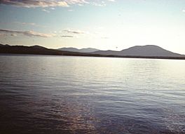
Evening light, South Twin Lake
|
|
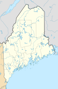
| Location | Penobscot County, Maine |
| Coordinates | 45°37′N 68°51′W / 45.617°N 68.850°W |
| Type | Natural Lake |
| Basin countries | United States |
| Max. length | 4 miles (6 km) |
| Max. width | 1.25 miles (2 km) |
| Surface area | 3,200 acres (13 km2) |
| Average depth | 30 feet (9 m) |
| Max. depth | 55 feet (17 m) |
| Shore length1 | 14 miles (20 km) |
| Surface elevation | 492 feet (150 m) |
| 1 Shore length is not a well-defined measure. | |
South Twin Lake is a large lake located entirely within Penobscot County, Maine. It covers about 3,200 acres (which is roughly 13 square kilometers). The lake is about 6 miles (10 km) west of Millinocket, Maine. It is also part of a group of lakes known as the Pemadumcook Chain of Lakes. The water from South Twin Lake flows into the West Branch of the Penobscot River.
Contents
Exploring South Twin Lake
South Twin Lake is a great place to visit. There is a special boat ramp in Partridge Cove. You can find it off Maine State Route 11. This makes it easy for people to launch their boats.
Along the east side of the lake, you will find Route 11. There are also tracks for the Montreal, Maine and Atlantic Railway. The lake is about 4 miles (6.4 km) long from west to east. It is about 1.25 miles (2 km) wide from north to south. A gravel road called Turkey Tail runs along the south side. This road connects to Route 11 at Partridge Cove.
When you are on the lake, watch out for rocks. Some rocks can be hidden just under the water. In the spring, you might also see logs floating in the lake. The ice on the lake usually melts around May 1st each year.
Plants and Animals of the Lake
The area around South Twin Lake is covered by forests. These are mostly "second growth" forests. This means the trees have grown back after older ones were cut down.
Trees Around the Lake
You can see many types of trees here.
- Hemlock
- Red spruce
- Balsam fir
- White pines
- Aspen
- White birch
- Yellow birch
- Red oak
- Red maple
- Sugar maple
- Black ash
Fish in the Lake
Many different kinds of fish live in South Twin Lake.
Some smaller streams flow into the lake. These include Lincoln Brook and Ragged Brooks.
Islands and Reefs
South Twin Lake has a few islands and rocky areas.
- Len's Island (Isle of Len): This is a private island. It is near the south shore, east of Ragged Brook.
- Peanut Island: This island has some large boulders. It is in the northeast part of the lake.
- Rock Reef: A line of rocks stretches north from Peanut Island. This reef goes all the way to the Rock Pile. The Rock Pile is on the northern edge of South Twin Lake.
History of the Lake
The history of South Twin Lake is closely tied to the North Twin Dam. A famous writer named Henry David Thoreau traveled near this lake in 1846. He noted that there were many large white pine trees around South Twin Lake.
In the 1800s, laws were passed to allow dams to be built on lakes like North Twin. A dam was built on North Twin Lake by 1846. It was about 12 feet (3.7 meters) high. Later, in 1867, the dam was made even taller, reaching 16 feet (4.9 meters). The current dam was built much later, between 1903 and 1904. It was built by the Great Northern Paper Company.
 | Audre Lorde |
 | John Berry Meachum |
 | Ferdinand Lee Barnett |


