
Pemadumcook Chain of Lakes facts for kids
Quick facts for kids Pemadumcook Chain of Lakes |
|
|---|---|

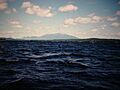
Evening light, South Twin Lake
|
|

Pemadumcook Chain of Lakes
Location in Maine

Pemadumcook Chain of Lakes
Location in the United States
|
|
| Location | Penobscot County, Maine Piscataquis County, Maine |
| Coordinates | 45°42′N 68°57′W / 45.700°N 68.950°W |
| Type | Natural lake |
| Basin countries | United States |
| Max. length | 14 miles (23 km) |
| Max. width | 2.5 miles (4 km) |
| Surface area | 18,300 acres (7,400 ha) |
| Average depth | 35 feet (11 m) |
| Max. depth | 103 feet (31 m) |
| Shore length1 | 65 miles (100 km) |
| Surface elevation | 492 feet (150 m) |
| 1 Shore length is not a well-defined measure. | |
The Pemadumcook Chain of Lakes is a group of large lakes in north-central Maine, a state in the United States. These lakes are a major part of the Penobscot River system. They offer beautiful views and are important for the local environment.
Contents
What's in a Name?
The name "Pemadumcook" comes from the Penobscot language. It means "lake with gravelly or sandy bottom or sand bars." This name perfectly describes parts of the lake's floor. Early maps and writings used slightly different names, like "Pamadumcook" or "Bennedumcook." However, the official name became "Pemadumcook Lake" in 1897.
Exploring the Geography
The Pemadumcook Chain of Lakes is the biggest body of water you can see when looking south from Mount Katahdin. It is Maine's fifth-largest lake system. Only Moosehead Lake, Sebago Lake, Chesuncook Lake, and Flagstaff Lake are larger. The Pemadumcook Chain covers about 18,300 acres (74 km2).
The Lakes in the Chain
This chain includes several connected lakes:
- Ambajejus Lake
- Elbow Lake
- North Twin Lake
- Pemadumcook Lake
- South Twin Lake
These lakes are all part of the West Branch of the Penobscot River. The river flows through these lakes, connecting them.
River Flow and Channels
The West Branch River enters Ambajejus Lake from the northwest. It then flows south through this lake. The river channel continues east into Pemadumcook Lake. From there, it moves into North Twin Lake. The channel then goes southeast across North Twin Lake. It passes by places like Perrow Point and Spring Island. Finally, it flows east through Elbow Lake to the North Twin dam. This main channel is about 11.5 miles (20 km) long. The entire lake chain stretches almost 14 miles (23 km) from end to end.
Islands and Deep Spots
The Pemadumcook Chain has many islands. The Porus Islands are in Pemadumcook Lake. They help separate Pemadumcook from Ambajejus Lake. Jo Mary Island is on the south side of Pemadumcook. Moose Island and Gull Rock are on the north side.
Between North Twin Lake and South Twin Lake, you'll find more islands. The channel connecting these two lakes is called the Narrows. In South Twin Lake, there are islands like the Rock Pile and Peanut Island.
The deepest parts of the lake are about 101 feet (31 m) deep. One deep spot is southwest of Moose Island in Pemadumcook. Another is 92 feet (28 m) deep in Ambajejus Lake. The lakes also have many rocks and floating logs, especially after spring runoff. Boaters need to be careful of these hazards.
Water Sources and Access
Several streams feed into the Pemadumcook Chain of Lakes. These include Ragged Brook and Lincoln Brook in South Twin Lake. The West Branch of the Penobscot flows into Ambajejus. Jo Mary Stream and Nahmakanta Stream also add water to Pemadumcook Lake.
Getting to the Lakes
You can reach the lakes by road. Maine State Route 11 runs along the east side. This road goes past Partridge Cove and up to Norcross. The town of Millinocket is about 5 miles (8 km) east of Norcross.
A paved road from Millinocket leads to Spencer Cove. This spot is at the northeast end of Ambajejus Lake. A dike built by the Great Northern Paper Company keeps water from flowing from Ambajejus Lake into the nearby Millinocket Lake.
Surrounding Areas
North of the lakes is Baxter State Park, a large wilderness area. To the west are the Nahmakanta Public lands. There is a public boat ramp in Partridge Cove, which is off Route 11.
Scientists measure water clarity using a Secchi Disk. In 2007, the average clarity was 4.8 meters. This means you could see about 4.8 meters down into the water.
Fish and Wildlife
The Pemadumcook Chain of Lakes is home to many types of fish. Anglers can find:
- Brook Trout
- Lake Trout (also called Togue)
- Atlantic Salmon (a landlocked type)
- Whitefish
- Chain Pickerel
- American Eel
- white perch
- yellow perch
- Chubs
- Minnows
- Sunfishes
- Hornpout (Brown bullhead)
- Largemouth Bass
- Smallmouth Bass
A Look Back in History
People have known about and explored the Pemadumcook Chain of Lakes for a long time.
Early Surveys
One of the first detailed maps of the area was the Large Crown Map from 1764. It was created by Joseph Chadwick, a British surveyor. He mapped the Penobscot River, and the lakes appeared on his map as "Bennedumcook."
In 1804, Charles Turner, Jr. described the view from Katahdin. He mentioned a "large lake" north of the Piscataquis Mountains.
Famous Visitors
The famous writer Henry David Thoreau visited the lakes in September 1846. He wrote about his journey in his book The Maine Woods. He noted that maps called the whole chain "Pamadumcook Lake," even though they were separate lakes connected by the river.
Another writer, Theodore Winthrop, wrote about the lakes in Life in the Open Air (around 1856). He described the lakes as "irregular as the verb To Be." He also shared a story about a sudden storm on the lake.
Charles E. Hamlin wrote about the lakes in 1881 for the Appalachian Mountain Club journal. He described the journey through the various lakes and connecting river sections. He mentioned "Ambejijis House," a log camp, as one of the few buildings in the area at that time.

Images for kids
-
View up the Narrows into North Twin
