
Saint-Dizier facts for kids
Quick facts for kids
Saint-Dizier
|
||
|---|---|---|

Notre-Dame church, Saint-Dizier
|
||
|
||
| Country | France | |
| Region | Grand Est | |
| Department | Haute-Marne | |
| Arrondissement | Saint-Dizier | |
| Canton | Chief town of 3 cantons | |
| Intercommunality | Saint-Dizier, Der et Blaise | |
| Area
1
|
47.7 km2 (18.4 sq mi) | |
| Population
(2013)
|
25,626 | |
| • Density | 537.2/km2 (1,391.4/sq mi) | |
| Demonym(s) | Bragards | |
| Time zone | UTC+01:00 (CET) | |
| • Summer (DST) | UTC+02:00 (CEST) | |
| INSEE/Postal code |
52448 /52100
|
|
| Elevation | 123–205 m (404–673 ft) (avg. 164 m or 538 ft) |
|
| Website | www.saint-dizier.fr | |
| 1 French Land Register data, which excludes lakes, ponds, glaciers > 1 km2 (0.386 sq mi or 247 acres) and river estuaries. | ||

Saint-Dizier is a town in France. It is a special kind of town called a commune. It is also a subprefecture in the Haute-Marne area. This area is part of the Grand Est region of France.
Contents
Exploring Saint-Dizier's Location
Saint-Dizier is a town in the northeast of France. It is located in the northern part of the Haute-Marne area. The town is close to the Meuse and Marne areas.
The total area of Saint-Dizier is about 47.7 km2 (18.4 sq mi). The average height of the town above sea level is 164 m (538 ft). At the town hall, the height is 143 m (469 ft).
Saint-Dizier is surrounded by several other towns. These include Trois-Fontaines-l'Abbaye, Chancenay, Bettancourt-la-Ferrée, and Ancerville. Other nearby towns are Chamouilley, Eurville-Bienville, Troisfontaines-la-Ville, Humbécourt, Laneuville-au-Pont, Moëslains, Valcourt, Hallignicourt, and Villiers-en-Lieu.
Two rivers flow through Saint-Dizier. These rivers are called the Ornel and the Marne. The town is also about 8 km (5.0 mi) from a very large lake. This lake is called Lac du Der-Chantecoq. It is the biggest man-made lake in Western Europe.
Saint-Dizier's Climate
Saint-Dizier has a climate known as a "Marine West Coast Climate." This type of climate is also called "Cfb" in the Köppen climate classification system.
The average amount of precipitation (rain and snow) each year is 1,450.3 mm (57.1 in). The average temperature for the year is 11.2 °C (52.2 °F).
| Climate data for Saint-Dizier, France | |||||||||||||
|---|---|---|---|---|---|---|---|---|---|---|---|---|---|
| Month | Jan | Feb | Mar | Apr | May | Jun | Jul | Aug | Sep | Oct | Nov | Dec | Year |
| Mean daily maximum °C (°F) | 6.1 (43.0) |
7.6 (45.7) |
11.7 (53.1) |
15.4 (59.7) |
19.7 (67.5) |
22.8 (73.0) |
25.5 (77.9) |
25.1 (77.2) |
20.8 (69.4) |
16 (61) |
10 (50) |
6.6 (43.9) |
15.6 (60.1) |
| Daily mean °C (°F) | 3.2 (37.8) |
4 (39) |
7.3 (45.1) |
10.2 (50.4) |
14.4 (57.9) |
17.4 (63.3) |
19.8 (67.6) |
19.4 (66.9) |
15.7 (60.3) |
11.9 (53.4) |
6.8 (44.2) |
4 (39) |
11.2 (52.1) |
| Mean daily minimum °C (°F) | 0.3 (32.5) |
0.3 (32.5) |
2.8 (37.0) |
4.9 (40.8) |
9.1 (48.4) |
12 (54) |
14.1 (57.4) |
13.7 (56.7) |
10.6 (51.1) |
7.7 (45.9) |
3.6 (38.5) |
1.3 (34.3) |
6.7 (44.1) |
| Average rainfall mm (inches) | 128.8 (5.07) |
111.5 (4.39) |
103.5 (4.07) |
129.7 (5.11) |
113.9 (4.48) |
87.8 (3.46) |
69.3 (2.73) |
98.4 (3.87) |
119.6 (4.71) |
152.1 (5.99) |
185.9 (7.32) |
150.4 (5.92) |
1,450.9 (57.12) |
| Source: Weatherbase.com [1] | |||||||||||||
Saint-Dizier's Population
In 2013, the town of Saint-Dizier had 25,626 people living there. This makes it the town with the most people in the Haute-Marne area. It even has more people than Chaumont, which is the main city of the area.
The number of people living in Saint-Dizier per square kilometer is 537. This is called the population density.
The people who live in Saint-Dizier have a special name in French. Men are called Bragards or Bragars. Women are called Bragardes or Bragares.
More About Saint-Dizier
Images for kids
-
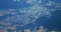
Aerial view of Saint-Dizier

See also
 In Spanish: Saint-Dizier para niños
