San Bartolomé, Las Palmas facts for kids
Quick facts for kids
San Bartolomé
|
|||
|---|---|---|---|
|
Municipality
|
|||
|
|||
| Etymology: Saint Bartholomew | |||
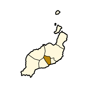
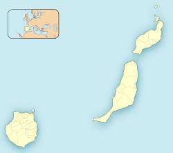
Municipal location in Lanzarote
|
|||
| Country | |||
| Autonomous Community | |||
| Province | Las Palmas | ||
| Island | Lanzarote | ||
| Area | |||
| • Total | 40.89 km2 (15.79 sq mi) | ||
| Elevation
(AMSL)
|
240 m (790 ft) | ||
| Population
(2019)
|
|||
| • Total | 18,816 | ||
| • Density | 460.16/km2 (1,191.81/sq mi) | ||
| Time zone | UTC±0 (WET) | ||
| • Summer (DST) | UTC+1 (WEST) | ||
| Postal code |
35550
|
||
| Area code(s) | +34 (Spain) + 928 (Las Palmas) | ||
| Website | www.sanbartolome.es | ||
San Bartolomé is a town and a "municipality" (a type of local government area) in the Canary Islands, Spain. It is located in the center of Lanzarote, which is one of the Canary Islands. The municipality of San Bartolomé also reaches the southeastern coast of the island.
About San Bartolomé
San Bartolomé is a place named after Saint Bartholomew. It covers an area of about 40.89 square kilometers (15.79 square miles). In 2019, around 18,816 people lived there. This means it has about 460 people per square kilometer. The town is located 240 meters (787 feet) above sea level.
Location and Connections
The town of San Bartolomé is found northwest of Arrecife. Arrecife is the capital city of Lanzarote. You can travel between San Bartolomé and Arrecife using the LZ-20 road.
The municipality of San Bartolomé is surrounded by other areas. It is southwest of Teguise and southeast of Tinajo. Tinajo is where the famous Timanfaya National Park is located. San Bartolomé is also northeast of Tías.
A coastal town called Playa Honda is part of the San Bartolomé municipality. Playa Honda is to the southeast and sits between Arrecife and Lanzarote Airport.
What People Do in San Bartolomé
Many people in San Bartolomé work in different jobs. Some are craftsmen, which means they make things by hand. Others are farmers, growing food and crops.
A lot of people also work in the tourism industry. Tourism is when visitors come to the island for holidays. It is the biggest way people earn money on Lanzarote. These jobs include working in hotels, restaurants, or shops that cater to tourists.
See also
 In Spanish: San Bartolomé (Lanzarote) para niños
 | James Van Der Zee |
 | Alma Thomas |
 | Ellis Wilson |
 | Margaret Taylor-Burroughs |


