
Monte Cristi, Dominican Republic facts for kids
Quick facts for kids
San Fernando de Monte Cristi
|
||
|---|---|---|

Monte Cristi, Dominican Republic in downtown area.
|
||
|
||

San Fernando de Monte Cristi
Location in the Dominican Republic
|
||
| Country | ||
| Province | Monte Cristi | |
| Founded | 1506 | |
| Municipality since | 1822 | |
| Area | ||
| • Total | 455.5 km2 (175.9 sq mi) | |
| Elevation | 16 m (52 ft) | |
| Population
(2012)
|
||
| • Total | 42,657 | |
| • Density | 93.649/km2 (242.549/sq mi) | |
| • Demonym | Montecristeño(a) | |
| Distance to – Santo Domingo |
270 km |
|
| Municipal Districts | 0 |
|
| Climate | BSh | |

San Fernando de Monte Cristi, often called Montecristi, is the main town of Monte Cristi Province in the Dominican Republic. It is located in the northwest part of the country, right on the coast near the border with Haiti.
This town was a leader in many new developments. It had the first aqueduct (water system), first railroad, and first telephone on the island. In 1895, a very important event happened here. Máximo Gómez and José Martí signed the Manifesto of Montecristi at Gómez's home. This document was a call for Cuba's independence. After signing, they sailed from "La Granja" beach in Montecristi to Cuba to join the fight for freedom.
Contents
History of Montecristi
Monte Cristi was officially started by Nicolás de Ovando in 1506. More people came in 1533 when Juan de Bolaños brought 63 families from the Canary Islands. The discovery of valuable minerals made more Spanish settlers want to live there. In 1545, even more families arrived, helping the town grow.
The first settlers in Montecristi mainly focused on farming and raising cattle. Even though the town was between two sugarcane-growing areas, sugarcane wasn't a big crop here.
Pirates and Trade
During the 1600s, Montecristi was a popular spot for pirates in the Caribbean Sea. Later, in 1756, the city became a busy trading center. This lasted until the early 1900s.
Around 1740, the island of Santo Domingo started to change a lot. The French had set up their own colony in the western part of the island. This made the Spanish colony begin to develop more, after being outside major trade for over a century.
To help with this, Spanish leaders started a plan around 1684. They brought families from the Canary Islands to settle in important places. This helped to stop the French from expanding on the island. Montecristi was one of these key locations. Its new beginning started in 1751. The Spanish wanted to create a strong border and also use the port for international trade.
In 1756, the ports of Montecristi and Puerto Plata were made "free ports" for ten years. This meant ships could trade there without many taxes. This helped the community grow a lot. By 1785, Montecristi had expanded greatly. Records show that about 5,550 people lived in both Puerto Plata and Montecristi combined.
Important Moments in History
In 1895, the Manifesto of Montecristi was signed here by Máximo Gómez and José Martí. They signed it at Gómez's house on Mella Street. After signing, they left from "La Granja" beach in Monte Cristi. Their journey was to Cuba to fight for its independence.
Rosa Smester Marrero, an educator and feminist from Santiago, moved to Monte Cristi in 1913. She became a teacher at the Higher Normal School of Montecristi. She also led the Higher School of Ladies of Montecristi.
Climate in Montecristi
Monte Cristi has a hot semi-arid climate. This means it's usually warm and dry. It has a clear dry season in the summer and a wet season in the winter. The average temperature is about 26.5 degrees Celsius (80 degrees Fahrenheit). The town gets about 650 millimeters (25.6 inches) of rain each year.
The eastern part of the park gets the most rain. This is because winds hit the Northern Range mountains there and release their water. The same thing happens near Manzanillo. These winds also hit the Central Cordillera and its extension in Haiti. This brings more rain to areas like Loma de Cabrera and Dajabón, and a bit less to Manzanillo.
Hurricanes and tropical storms do not usually affect Monte Cristi much. However, they can cause heavy rains and floods in the Yaque del Norte River. This river then carries dirt and mud that can harm the coral reefs in the area. In winter, cold air from North America can bring lower temperatures and strong winds from the north. Also, cold currents from the deep ocean can rise up when they hit the island's underwater shelf.
| Climate data for Monte Cristi (1991–2020) | |||||||||||||
|---|---|---|---|---|---|---|---|---|---|---|---|---|---|
| Month | Jan | Feb | Mar | Apr | May | Jun | Jul | Aug | Sep | Oct | Nov | Dec | Year |
| Mean daily maximum °C (°F) | 30.0 (86.0) |
30.2 (86.4) |
30.2 (86.4) |
30.8 (87.4) |
31.6 (88.9) |
33.5 (92.3) |
33.5 (92.3) |
33.5 (92.3) |
33.1 (91.6) |
32.4 (90.3) |
30.6 (87.1) |
29.8 (85.6) |
31.6 (88.9) |
| Daily mean °C (°F) | 25.1 (77.2) |
25.3 (77.5) |
25.5 (77.9) |
26.4 (79.5) |
27.1 (80.8) |
28.8 (83.8) |
28.8 (83.8) |
28.8 (83.8) |
28.3 (82.9) |
27.8 (82.0) |
26.3 (79.3) |
25.3 (77.5) |
27.0 (80.6) |
| Mean daily minimum °C (°F) | 20.1 (68.2) |
20.4 (68.7) |
20.8 (69.4) |
21.9 (71.4) |
22.7 (72.9) |
24.0 (75.2) |
24.2 (75.6) |
24.1 (75.4) |
23.5 (74.3) |
23.1 (73.6) |
22.0 (71.6) |
20.8 (69.4) |
22.3 (72.1) |
| Average precipitation mm (inches) | 52.4 (2.06) |
42.0 (1.65) |
58.2 (2.29) |
56.2 (2.21) |
64.7 (2.55) |
22.8 (0.90) |
21.6 (0.85) |
32.5 (1.28) |
51.1 (2.01) |
61.9 (2.44) |
141.2 (5.56) |
50.1 (1.97) |
654.6 (25.77) |
| Source: NOAA | |||||||||||||
| Climate data for Monte Cristi (1971-2000) | |||||||||||||
|---|---|---|---|---|---|---|---|---|---|---|---|---|---|
| Month | Jan | Feb | Mar | Apr | May | Jun | Jul | Aug | Sep | Oct | Nov | Dec | Year |
| Record high °C (°F) | 34.2 (93.6) |
35.5 (95.9) |
34.8 (94.6) |
34.2 (93.6) |
36.0 (96.8) |
37.3 (99.1) |
37.3 (99.1) |
38.0 (100.4) |
38.4 (101.1) |
36.6 (97.9) |
35.7 (96.3) |
34.5 (94.1) |
38.4 (101.1) |
| Mean daily maximum °C (°F) | 29.4 (84.9) |
29.5 (85.1) |
30.2 (86.4) |
30.5 (86.9) |
31.7 (89.1) |
33.3 (91.9) |
33.6 (92.5) |
33.7 (92.7) |
33.4 (92.1) |
32.7 (90.9) |
31.1 (88.0) |
29.7 (85.5) |
31.6 (88.8) |
| Daily mean °C (°F) | 24.2 (75.6) |
24.4 (75.9) |
25.0 (77.0) |
25.7 (78.3) |
26.8 (80.2) |
28.1 (82.6) |
28.3 (82.9) |
28.3 (82.9) |
28.0 (82.4) |
27.4 (81.3) |
26.1 (79.0) |
24.6 (76.3) |
26.4 (79.5) |
| Mean daily minimum °C (°F) | 19.0 (66.2) |
19.4 (66.9) |
20.0 (68.0) |
20.9 (69.6) |
22.0 (71.6) |
22.9 (73.2) |
23.0 (73.4) |
23.0 (73.4) |
22.7 (72.9) |
22.2 (72.0) |
21.1 (70.0) |
19.5 (67.1) |
21.3 (70.4) |
| Record low °C (°F) | 14.5 (58.1) |
15.0 (59.0) |
14.7 (58.5) |
16.2 (61.2) |
17.0 (62.6) |
19.0 (66.2) |
20.0 (68.0) |
19.8 (67.6) |
18.0 (64.4) |
18.0 (64.4) |
16.2 (61.2) |
14.0 (57.2) |
14.0 (57.2) |
| Average rainfall mm (inches) | 67.8 (2.67) |
47.2 (1.86) |
53.5 (2.11) |
70.9 (2.79) |
52.7 (2.07) |
31.0 (1.22) |
15.4 (0.61) |
27.0 (1.06) |
33.4 (1.31) |
59.9 (2.36) |
66.4 (2.61) |
70.0 (2.76) |
595.2 (23.43) |
| Average rainy days (≥ 1.0 mm) | 4.7 | 4.3 | 3.9 | 5.5 | 5.7 | 2.9 | 1.8 | 2.7 | 3.6 | 5.5 | 5.6 | 5.9 | 52.1 |
| Average relative humidity (%) | 79.1 | 77.8 | 76.9 | 77.2 | 78.5 | 75.4 | 73.1 | 73.8 | 75.1 | 76.7 | 77.3 | 78.9 | 76.6 |
| Source: ONAMET | |||||||||||||
| Climate data for Monte Cristi (1961-1990) | |||||||||||||
|---|---|---|---|---|---|---|---|---|---|---|---|---|---|
| Month | Jan | Feb | Mar | Apr | May | Jun | Jul | Aug | Sep | Oct | Nov | Dec | Year |
| Record high °C (°F) | 34.2 (93.6) |
35.5 (95.9) |
36.0 (96.8) |
38.0 (100.4) |
36.0 (96.8) |
38.0 (100.4) |
39.0 (102.2) |
38.5 (101.3) |
39.0 (102.2) |
37.0 (98.6) |
37.0 (98.6) |
35.0 (95.0) |
39.0 (102.2) |
| Mean daily maximum °C (°F) | 28.9 (84.0) |
29.4 (84.9) |
30.2 (86.4) |
30.5 (86.9) |
31.8 (89.2) |
33.3 (91.9) |
33.6 (92.5) |
33.8 (92.8) |
33.7 (92.7) |
32.7 (90.9) |
30.7 (87.3) |
29.2 (84.6) |
31.5 (88.7) |
| Daily mean °C (°F) | 24.1 (75.4) |
24.5 (76.1) |
25.1 (77.2) |
25.8 (78.4) |
27.0 (80.6) |
28.2 (82.8) |
28.4 (83.1) |
28.5 (83.3) |
28.3 (82.9) |
27.5 (81.5) |
25.9 (78.6) |
24.5 (76.1) |
26.5 (79.7) |
| Mean daily minimum °C (°F) | 19.2 (66.6) |
19.6 (67.3) |
20.1 (68.2) |
21.1 (70.0) |
22.2 (72.0) |
23.0 (73.4) |
23.2 (73.8) |
23.3 (73.9) |
22.9 (73.2) |
22.4 (72.3) |
21.3 (70.3) |
19.8 (67.6) |
21.5 (70.7) |
| Record low °C (°F) | 14.0 (57.2) |
15.0 (59.0) |
14.7 (58.5) |
16.0 (60.8) |
17.0 (62.6) |
19.0 (66.2) |
20.0 (68.0) |
19.8 (67.6) |
18.0 (64.4) |
18.0 (64.4) |
16.2 (61.2) |
14.0 (57.2) |
14.0 (57.2) |
| Average rainfall mm (inches) | 73.8 (2.91) |
47.3 (1.86) |
47.7 (1.88) |
59.0 (2.32) |
59.8 (2.35) |
40.1 (1.58) |
21.5 (0.85) |
28.1 (1.11) |
34.8 (1.37) |
67.7 (2.67) |
108.2 (4.26) |
84.1 (3.31) |
672.1 (26.46) |
| Average rainy days (≥ 1.0 mm) | 5.0 | 3.7 | 3.2 | 4.4 | 5.4 | 3.2 | 2.1 | 2.8 | 3.7 | 5.7 | 6.6 | 6.5 | 52.3 |
| Average relative humidity (%) | 79.3 | 78.0 | 76.7 | 77.4 | 78.7 | 75.9 | 73.1 | 73.6 | 74.8 | 76.7 | 77.3 | 79.2 | 76.7 |
| Source: NOAA | |||||||||||||
Osvaldo Virgil Airport
Osvaldo Virgil Airport serves the city and province of Monte Cristi. It is located in the northern part of the country. The airport was closed for a long time. It reopened in 2007 after being updated by the Airport Department.
The airport is named after Osvaldo Virgil. He was the first baseball player from the Dominican Republic to play in Major League Baseball. He was born in Monte Cristi. The airport's runway and buildings were constructed under the guidance of Manuel Isidor, an engineer from Montecristi.
Culture and Traditions
Montecristi has many interesting traditions. One of the most important is the patron saint festival of San Fernando. This celebration happens every May 30th. It includes religious events, sports, dances, and a fishing tournament.
Another popular event is the celebration of San Juan Bautista Day on June 24th. The Carnival of the Bulls is also a very crowded and exciting event. One of Montecristi's main cultural treasures is the first pyramid marking the border between the Dominican Republic and Haiti.
Images for kids
-
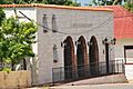
Montecristi town museum.
-
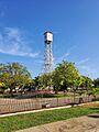
Clocktower of Monte Cristi, Dominican Republic in downtown area.


See also
 In Spanish: Monte Cristi (República Dominicana) para niños
