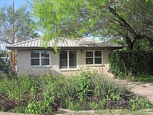
San Ygnacio, Texas facts for kids
Quick facts for kids
San Ygnacio, Texas
|
|
|---|---|
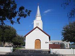
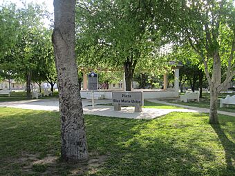
Historic Our Lady of Refugio Catholic Church is located at the intersection of Laredo and Washington streets across from the Blas Maria Uribe Plaza in San Ygnacio
|
|
 |
|
| Country | United States |
| State | Texas |
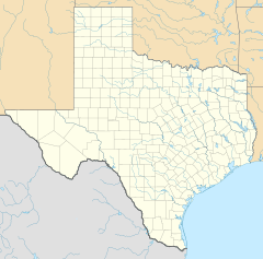
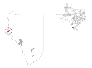
| County | Zapata |
| Area | |
| • Total | 1.6 sq mi (4 km2) |
| • Land | 1.5 sq mi (4 km2) |
| • Water | 0.1 sq mi (0.3 km2) |
| Population
(2020)
|
|
| • Total | 504 |
| • Density | 315/sq mi (122/km2) |
| Time zone | UTC-6 (Central (CST)) |
| • Summer (DST) | UTC-5 (CDT) |
| Zip Code |
78067
|
| FIPS code | 48-65792 |
San Ygnacio is a small community in Zapata County, Texas, United States. It is a "census-designated place" (CDP), which means it's an area identified by the U.S. Census Bureau for statistical purposes. In 2020, about 504 people lived there. The town is named after a famous Spanish saint, Ignatius of Loyola. A special part of San Ygnacio, located between the Rio Grande river and U.S. Highway 83, is known as the San Ygnacio Historic District. It is listed on the National Register of Historic Places (NRHP) because of its important history.
Contents
History of San Ygnacio
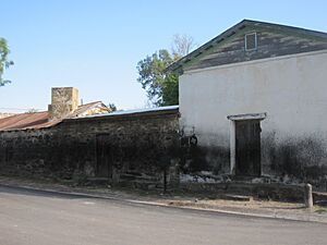
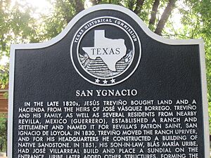
San Ygnacio began as a Mexican village in 1830. It was founded by people from a nearby town called Guerrero, Tamaulipas. They settled near the recently started Uribeno Ranch. In the early days, the community faced many attacks from the Comanche people. Because of this, the settlers built their homes and buildings using strong stone. These stone buildings are still standing today and are important historical sites.
San Ygnacio's Role in Revolutions
San Ygnacio played a part in the short-lived Rio Grande Republic. This new republic was formed during meetings held in the town in 1839. It was an attempt by some Mexican states to break away and form their own country.
Later, San Ygnacio was also involved in the Garza Revolution from 1891 to 1893. Several small battles took place near the town during this time. These battles happened on both Mexican and American land.
In June 1916, San Ygnacio was attacked by Mexican soldiers called Carrancistas or by a group known as Seditionists. On June 10, about 100 Mexican fighters had a battle with around 150 American soldiers from the 14th Cavalry. The American soldiers won this fight.
Surviving the Flood
In 1953, many towns in the region were moved because of a planned flood. This flood created Falcon Lake and a "New" Zapata. However, the people of San Ygnacio asked to stay on their land. Their town was built on high ground, so it was safe from the rising water.
Because San Ygnacio survived, its old buildings were recognized as very important. In 1972, the town was added to the National Register of Historic Places. It is one of the last places with this type of 19th-century Mexican ranch architecture. The oldest building, the Treviño-Uribe Rancho, was built in 1830 and is now a National Historic Landmark.
The River Pierce Foundation is a private group that works to help restore and protect the historic buildings in San Ygnacio.
San Ygnacio in Film
San Ygnacio was also a filming location for the 1952 movie Viva Zapata.
Geography of San Ygnacio
San Ygnacio is located at 27°2′38″N 99°26′23″W / 27.04389°N 99.43972°W. The community covers a total area of about 1.6 square miles (4.1 square kilometers). Most of this area is land, with a small part being water.
Wildlife in San Ygnacio
San Ygnacio is a special place for birdwatchers. It is one of the few spots in the United States where you can see the Morelet’s seedeater. This is a small bird, similar to a sparrow. It lives in tall grass and plants along the Rio Grande river.
Population and People
| Historical population | |||
|---|---|---|---|
| Census | Pop. | %± | |
| 2000 | 504 | — | |
| U.S. Decennial Census 1850–1900 1910 1920 1930 1940 1950 1960 1970 1980 1990 2000 2010 |
|||
In 2000, there were 853 people living in San Ygnacio. Most of the people living in San Ygnacio are of Hispanic or Latino background.
Education in San Ygnacio
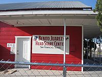
All schools in Zapata County, including those in San Ygnacio, are part of the Zapata County Independent School District.
See also
 In Spanish: San Ygnacio (Texas) para niños
 | Lonnie Johnson |
 | Granville Woods |
 | Lewis Howard Latimer |
 | James West |


