Sandy Flat, New South Wales facts for kids
Quick facts for kids Sandy FlatNew South Wales |
|
|---|---|

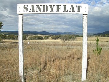
Sandy Flat rail siding sign
|
|
| Population | 209 (2011 census) |
| Postcode(s) | 2372 |
| Elevation | 805 m (2,641 ft) |
| Location |
|
| LGA(s) | Tenterfield Shire |
| County | Clive County |
| State electorate(s) | Lismore |
| Federal Division(s) | New England |
Sandy Flat is a small, historic place in the New England region of New South Wales, Australia. It is located on the Northern Tablelands, which is a high, flat area of land. You can find it about 20 kilometers south of a town called Tenterfield. Sandy Flat is right on the New England Highway and used to be on the Main North Railway line. In 2011, about 209 people lived in Sandy Flat. The name "Sandy Flat" simply describes the sandy, flat land in the area. A famous landmark nearby is Bluff Rock, which many people photograph.
Contents
History of Sandy Flat
The first people to live in this area were Aboriginal people from the Kamilaroi clan.
For many years, community life in Sandy Flat was centered around a few important places. There was a school that operated from 1886 to 1965. The town also had a public hall, a church, and a general store. When the railway line was being built in the 1880s, Sandy Flat even had its own hotel!
The Railway and Post Office
The Main Northern Railway line, which connected to Jennings, opened on September 1, 1886. The train station at Sandy Flat was an important stop for many years, but it closed on February 20, 1975. The Sandy Flat Post Office opened a bit later, on June 20, 1887.
Bluff River Rail Bridge
The Bluff River Rail Bridge at Sandy Flat is a very special structure. It was designed by a famous engineer named John Whitton. This bridge is made of timber and has 10 sections, each about 12.8 meters long. When it was finished in 1886, it was the second longest timber bridge of its kind in Australia! Today, it is listed on the Register of the National Estate, which means it's an important historical site.
What Remains Today
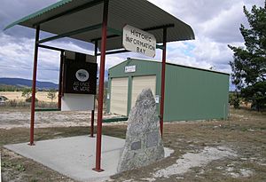
Today, you can still see parts of the old Sandy Flat community. There are remains of the former train siding, which is where trains used to park. You can also see the old post office building, which is no longer used. There is a modern shed for the New South Wales Rural Fire Service, which helps fight fires. An information stand also tells visitors about the area. Around Sandy Flat, you will find scattered farms.
Sports and Recreation
People in Sandy Flat enjoyed many traditional sports like tennis, cricket, and football. There was also a special place for shooting sports. The Sandy Flat Rifle Range was a popular spot for men, especially around the time of World War I. This range was 1,000 yards long and opened in 1913. It even had a telephone connection and a large shelter for its sixty or so members.
Local Industries
The main industries in Sandy Flat involve farming. Farmers in the area raise merino sheep, which are known for their fine wool. They also have farms for beef cattle.
Sandy Flat Railway Station
| Preceding station | Former Services | Following station | ||
|---|---|---|---|---|
| Tenterfield
towards Wallangarra
|
Main North Line | Bolivia
towards Sydney
|
||
 | May Edward Chinn |
 | Rebecca Cole |
 | Alexa Canady |
 | Dorothy Lavinia Brown |


