Sasakwa, Oklahoma facts for kids
Quick facts for kids
Sasakwa, Oklahoma
|
|
|---|---|

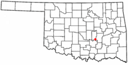
Location of Sasakwa, Oklahoma
|
|
| Country | United States |
| State | Oklahoma |
| County | Seminole |
| Area | |
| • Total | 0.21 sq mi (0.55 km2) |
| • Land | 0.21 sq mi (0.55 km2) |
| • Water | 0.00 sq mi (0.00 km2) |
| Elevation | 827 ft (252 m) |
| Population
(2020)
|
|
| • Total | 80 |
| • Density | 375.59/sq mi (144.69/km2) |
| Time zone | UTC-6 (Central (CST)) |
| • Summer (DST) | UTC-5 (CDT) |
| ZIP code |
74867
|
| Area code(s) | 405 |
| FIPS code | 40-65500 |
| GNIS feature ID | 2413261 |
Sasakwa is a small town in Seminole County, Oklahoma, United States. In 2020, 80 people lived there.
Contents
Sasakwa: A Look at Its Past
Sasakwa started in a different spot, about 12 miles west of where it is now. A man named Governor John E Brown, who was a Seminole leader, set up a trading post there. A trading post was a place where people could buy and sell goods. He also had a cotton gin, which was a machine that separated cotton fibers from their seeds.
The town got its name from the Seminole word for "wild goose." A post office opened in 1880. From 1880 to 1892, there was a school called Sasakwa Female Academy. At that time, Sasakwa was part of the Seminole Nation in what was known as the Indian Territory. The town later moved to its current spot because a train station was built there.
The Green Corn Rebellion
In 1917, a big event happened near Sasakwa. Many men gathered on a farm to protest against being forced to join the army for World War I. This event is known as the Green Corn Rebellion. It was a time when people showed their disagreement with the government's decision to draft soldiers.
Sasakwa's Location and Land
Sasakwa is located about 13 miles south of Wewoka. Wewoka is the main town, or "county seat," for Seminole County. The town of Sasakwa covers a total area of about 0.2 square miles, and all of it is land.
The town is right on Oklahoma State Highway 56. To the west of Sasakwa, you can find Lake Konawa.
Sasakwa's Changing Population
| Historical population | |||
|---|---|---|---|
| Census | Pop. | %± | |
| 1910 | 241 | — | |
| 1920 | 355 | 47.3% | |
| 1930 | 781 | 120.0% | |
| 1940 | 532 | −31.9% | |
| 1950 | 365 | −31.4% | |
| 1960 | 253 | −30.7% | |
| 1970 | 321 | 26.9% | |
| 1980 | 335 | 4.4% | |
| 1990 | 169 | −49.6% | |
| 2000 | 150 | −11.2% | |
| 2010 | 150 | 0.0% | |
| 2020 | 80 | −46.7% | |
| U.S. Decennial Census | |||
The number of people living in Sasakwa has changed a lot over the years. In 1930, the town had its highest population with 781 people. By 2020, the population was 80.
In the year 2000, there were 150 people living in Sasakwa. Most of the people were White or Native American. Some people were from two or more races. There were 58 households, and about a quarter of them had children under 18 living there.
Learning in Sasakwa
Students in Sasakwa attend schools that are part of the Sasakwa Public Schools district. This district provides education for the children living in the town and nearby areas.
Famous People from Sasakwa
Sasakwa was once home to two important Seminole Chiefs: John Jumper and John F. Brown. These leaders played key roles in the history of the Seminole Nation.
See also
 In Spanish: Sasakwa (Oklahoma) para niños
 | Chris Smalls |
 | Fred Hampton |
 | Ralph Abernathy |

