Sawyerville, Illinois facts for kids
Quick facts for kids
Sawyerville, Illinois
|
|
|---|---|

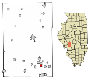
Location in Macoupin County, Illinois
|
|
| Country | United States |
| State | Illinois |
| County | Macoupin |
| Township | Mount Olive |
| Area | |
| • Total | 1.00 sq mi (2.59 km2) |
| • Land | 0.99 sq mi (2.56 km2) |
| • Water | 0.01 sq mi (0.04 km2) |
| Population
(2020)
|
|
| • Total | 268 |
| • Density | 271.26/sq mi (104.78/km2) |
| Time zone | UTC-6 (CST) |
| • Summer (DST) | UTC-5 (CDT) |
| ZIP code |
62085
|
| Area code(s) | 217 |
| FIPS code | 17-67873 |
Sawyerville is a small village located in Macoupin County, Illinois, in the United States. According to the 2020 census, about 268 people lived there.
Contents
Exploring Sawyerville's Location
Sawyerville is found in the southeastern part of Macoupin County. Its exact location is 39°4′41″N 89°48′23″W / 39.07806°N 89.80639°W.
Roads and Nearby Towns
Illinois Route 4 runs along the west side of the village. This road goes north about 3.5 miles (5.6 km) to Gillespie. It also goes south about 5 miles (8 km) to Staunton.
Illinois Route 138 is on the east side of Sawyerville. It goes north to Benld and east about 2.5 miles (4 km) to Interstate 55 near White City.
Land and Water Features
The U.S. Census Bureau states that Sawyerville covers a total area of 1.00 square mile (2.59 square kilometers). Most of this area, about 0.99 square miles (2.56 square kilometers), is land. A small part, about 0.014 square miles (0.04 square kilometers), is water.
An unnamed stream with a 50-foot (15-meter) deep ravine divides the village. This stream splits Sawyerville into a smaller eastern part and a larger western part. The village is also part of the Cahokia Creek watershed, which flows southwest towards the Mississippi River.
Understanding Sawyerville's Population
The population of Sawyerville has changed over the years. Here's a look at how many people have lived there during different census counts:
| Historical population | |||
|---|---|---|---|
| Census | Pop. | %± | |
| 1910 | 445 | — | |
| 1920 | 588 | 32.1% | |
| 1930 | 501 | −14.8% | |
| 1940 | 401 | −20.0% | |
| 1950 | 390 | −2.7% | |
| 1960 | 362 | −7.2% | |
| 1970 | 315 | −13.0% | |
| 1980 | 381 | 21.0% | |
| 1990 | 312 | −18.1% | |
| 2000 | 295 | −5.4% | |
| 2010 | 279 | −5.4% | |
| 2020 | 268 | −3.9% | |
| U.S. Decennial Census | |||
Population Details from 2000
In the year 2000, there were 295 people living in Sawyerville. There were 117 households, which means 117 different homes or groups of people living together. Out of these, 84 were families.
The population density was about 291 people per square mile (112 people per square kilometer). This tells us how crowded the area was. There were 127 housing units, which are places where people can live.
Most of the people in the village, about 97.63%, were White. A small number were African American (0.68%) or Native American (0.34%). About 1.36% of the population identified as being from two or more races.
Households and Families
About 31.6% of the households had children under 18 living with them. More than half, 57.3%, were married couples living together. About 12.8% of households had a female head of the house without a husband present. About 28.2% were non-families, meaning they were individuals or groups of unrelated people living together.
Around 23.1% of all households were made up of just one person. About 13.7% of households had someone aged 65 or older living alone. On average, there were 2.52 people in each household and 2.96 people in each family.
Age and Income Information
The population in Sawyerville was spread out across different age groups. About 24.1% were under 18 years old. About 9.2% were between 18 and 24. The largest group, 29.5%, was between 25 and 44 years old. About 18.0% were 65 years or older. The average age in the village was 38 years.
The median income for a household was $28,571. This means half of the households earned more than this amount, and half earned less. For families, the median income was $34,167. Males earned a median income of $30,000, while females earned $16,500. The per capita income for the village was $13,415. This is the average income per person.
About 10.5% of families and 15.4% of the total population lived below the poverty line. This included 17.9% of those under 18 and 22.6% of those 65 or older.
See also
 In Spanish: Sawyerville para niños
 | Chris Smalls |
 | Fred Hampton |
 | Ralph Abernathy |


