White City, Illinois facts for kids
Quick facts for kids
White City, Illinois
|
|
|---|---|

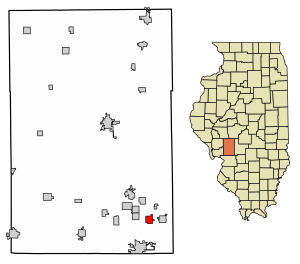
Location in Macoupin County, Illinois
|
|
| Country | United States |
| State | Illinois |
| County | Macoupin |
| Township | Mount Olive |
| Area | |
| • Total | 1.22 sq mi (3.15 km2) |
| • Land | 1.21 sq mi (3.14 km2) |
| • Water | 0.00 sq mi (0.01 km2) |
| Elevation | 652 ft (199 m) |
| Population
(2020)
|
|
| • Total | 212 |
| • Density | 174.92/sq mi (67.52/km2) |
| Time zone | UTC-6 (CST) |
| • Summer (DST) | UTC-5 (CDT) |
| ZIP code |
62069 (Mount Olive)
|
| Area code(s) | 217 |
| FIPS code | 17-81191 |
White City is a small village located in Macoupin County, Illinois, in the United States. In 2020, about 212 people lived there. It's a quiet place in the southeastern part of the county.
Contents
Where is White City?
White City is found in the southeastern part of Macoupin County. A major highway, Interstate 55, runs along the eastern side of the village. You can get to White City from Exit 44, which connects to Illinois Route 138.
Interstate 55 goes north for about 51 miles to Springfield, which is the state capital. If you travel southwest on I-55, you'll reach St. Louis in about 45 miles. Illinois Route 138 goes east about 1.5 miles to the center of Mount Olive. Mount Olive is also the mailing address for White City, using ZIP Code 62069. Route 138 also goes northwest about 3.5 miles to Benld.
The village covers an area of about 1.22 square miles. Most of this area is land, with a very small amount of water. Water from White City flows west into Cahokia Creek, which eventually reaches the Mississippi River.
People of White City
| Historical population | |||
|---|---|---|---|
| Census | Pop. | %± | |
| 1910 | 421 | — | |
| 1920 | 503 | 19.5% | |
| 1930 | 409 | −18.7% | |
| 1940 | 330 | −19.3% | |
| 1950 | 275 | −16.7% | |
| 1960 | 197 | −28.4% | |
| 1970 | 196 | −0.5% | |
| 1980 | 214 | 9.2% | |
| 1990 | 229 | 7.0% | |
| 2000 | 221 | −3.5% | |
| 2010 | 232 | 5.0% | |
| 2020 | 212 | −8.6% | |
| U.S. Decennial Census | |||
In 2000, there were 221 people living in White City. These people lived in 90 households, and 56 of these were families. The village had about 182 people per square mile.
- About 28.9% of the households had children under 18 living with them.
- 41.1% of households were married couples living together.
- 14.4% of households had a female head of the house with no husband present.
- About 32.2% of all households were made up of people living alone.
- 14.4% of households had someone aged 65 or older living alone.
The average household had 2.46 people, and the average family had 3.11 people.
Age Groups in White City
The population of White City was spread out across different age groups:
- 27.1% were under 18 years old.
- 7.2% were between 18 and 24 years old.
- 28.5% were between 25 and 44 years old.
- 20.8% were between 45 and 64 years old.
- 16.3% were 65 years old or older.
The average age in the village was 38 years. For every 100 females, there were about 95.6 males.
Income and Economy
In 2000, the average income for a household in White City was $26,000 per year. For families, the average income was $42,500 per year. The average income per person in the village was $14,826.
About 15.2% of families and 19.3% of all people in White City lived below the poverty line. This included 36.5% of those under 18 and 7.1% of those 65 or older.
See also
 In Spanish: White City (Illinois) para niños
 | Dorothy Vaughan |
 | Charles Henry Turner |
 | Hildrus Poindexter |
 | Henry Cecil McBay |


