
Scranton, Kansas facts for kids
Quick facts for kids
Scranton, Kansas
|
|
|---|---|

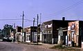
U.S Post Office in Scranton (2009)
|
|

Location within Osage County and Kansas
|
|

|
|
| Country | United States |
| State | Kansas |
| County | Osage |
| Founded | 1871 |
| Incorporated | 1872 |
| Named for | Scranton, Pennsylvania |
| Area | |
| • Total | 1.08 sq mi (2.80 km2) |
| • Land | 1.08 sq mi (2.79 km2) |
| • Water | 0.00 sq mi (0.01 km2) |
| Elevation | 1,122 ft (342 m) |
| Population
(2020)
|
|
| • Total | 653 |
| • Density | 605/sq mi (233.2/km2) |
| Time zone | UTC-6 (CST) |
| • Summer (DST) | UTC-5 (CDT) |
| ZIP code |
66537
|
| Area code | 785 |
| FIPS code | 20-63675 |
| GNIS ID | 479457 |
Scranton is a city located in Osage County, Kansas, in the United States. In 2020, about 653 people lived there. The city was named after Scranton, Pennsylvania. This was because both cities were important for coal mining in the 1800s.
Contents
History of Scranton
Scranton was started in 1871. It was first known as a coal town, a place where coal mining was the main activity. The city got its name from Scranton, Pennsylvania.
The first post office in Scranton opened in September 1872. This helped people send and receive mail.
Geography and Climate
Scranton is located at 38°46′46″N 95°44′17″W / 38.77944°N 95.73806°W. The city covers a total area of about 1.07 square miles (2.77 square kilometers). All of this area is land.
Scranton's Climate
The weather in Scranton has hot and humid summers. Winters are usually mild to cool. According to the Köppen Climate Classification system, Scranton has a humid subtropical climate. This type of climate is often shown as "Cfa" on climate maps.
Population and People
| Historical population | |||
|---|---|---|---|
| Census | Pop. | %± | |
| 1880 | 835 | — | |
| 1890 | 1,572 | 88.3% | |
| 1900 | 1,099 | −30.1% | |
| 1910 | 770 | −29.9% | |
| 1920 | 622 | −19.2% | |
| 1930 | 538 | −13.5% | |
| 1940 | 500 | −7.1% | |
| 1950 | 487 | −2.6% | |
| 1960 | 576 | 18.3% | |
| 1970 | 575 | −0.2% | |
| 1980 | 664 | 15.5% | |
| 1990 | 674 | 1.5% | |
| 2000 | 724 | 7.4% | |
| 2010 | 710 | −1.9% | |
| 2020 | 653 | −8.0% | |
| U.S. Decennial Census | |||
Scranton is part of the Topeka, Kansas Metropolitan Statistical Area. This means it is part of the larger Topeka city area.
Scranton's Population in 2010
In 2010, the city had 710 people living in 265 households. There were 189 families. The city's population density was about 663.6 people per square mile.
Most of the people in Scranton were White (97.6%). A small number were Native American (0.4%), Asian (0.6%), or from other races (0.8%). About 2.4% of the population was Hispanic or Latino.
About 37% of households had children under 18. Many households (54.7%) were married couples. The average household had 2.68 people. The average family had 3.19 people.
The average age in Scranton was 36.8 years old. About 30.3% of residents were under 18. About 14.5% were 65 or older. The city had slightly more females (51.3%) than males (48.7%).
Education in Scranton
The Santa Fe Trail USD 434 public school district serves Scranton. This district also includes the towns of Carbondale and Overbrook. Students attend Santa Fe Trail High School.
The Santa Fe Trail Chargers are the high school sports teams. The boys' basketball team won the Kansas State High School class 4A championship in 1997. The girls' basketball team won the same championship in 1998.
Images for kids
-
Scranton in 1974

See also
 In Spanish: Scranton (Kansas) para niños
