Serranía del Perijá facts for kids
Quick facts for kids Serranía del Perijá |
|
|---|---|

Cerro Pintao
|
|
| Highest point | |
| Peak | Cerro de las Tetas |
| Elevation | 3,630 m (11,910 ft) |
| Dimensions | |
| Length | 310 km (190 mi) |
| Geography | |
| Country | |
| State/Province | Norte de Santander Cesar La Guajira Zulia |
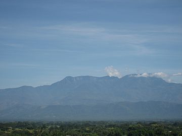
The Serranía del Perijá is a long mountain range in northern South America. It is also known as the Cordillera de Perijá or Sierra de Perijá. This mountain range is part of the eastern Andes mountains.
It stretches for about 310 kilometers (190 miles) between Colombia and Venezuela. The mountains end in the La Guajira Desert to the north. The Serranía del Perijá acts like a natural wall. It separates the Maracaibo Basin in Venezuela from the Cesar-Ranchería Basin in Colombia. Some parts of this area are protected as a special place for plants and animals.
Contents
Where is the Serranía del Perijá?
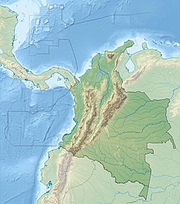
This mountain range starts in the south, near a town called Ocaña, Colombia. From there, it forms a natural border. First, it separates two Colombian regions: Norte de Santander and Cesar.
As the mountains go further north, they become the international border. This border is between Venezuela's Zulia State and Colombia's Cesar Department. The range includes smaller mountain groups. These are the Sierra Motilones, Sierra Valledupar, and Sierra Oca.
Highest Points in the Mountains
The tallest peak in the Serranía del Perijá is Cerro de Las Tetas. It stands at 3,630 meters (11,910 feet) high. Another high point is Cerro Irapa, which is 3,540 meters (11,610 feet) tall. Other notable peaks include Serranía de Macuira at 864 meters (2,835 feet) and Cerro Aceite at 853 meters (2,799 feet).
People of the Perijá Mountains
Most of the Serranía del Perijá, about 58%, is located in Venezuela. The remaining 42% is in Colombia. Both countries have created national parks here. Venezuela has a large park called Sierra de Perijá National Park. Colombia has a smaller protected area.
These mountains are home to several Amerindian groups. In the Venezuelan part, there are special areas for the Yucpa and Barí people. In Colombia, the Iroko and Sokorpa people live in their own territories. Venezuela has also started projects to build new communities along the border. These new towns help people like the Wayuu and Goajira peoples settle in the area.
Life and Farming in the Mountains
The climate in the Serranía del Perijá is mostly tropical. This means it has warm temperatures and a lot of rain. The mountains are covered in humid forests. Farmers in this region grow crops like coffee.
See also
 In Spanish: Serranía del Perijá para niños
 | Lonnie Johnson |
 | Granville Woods |
 | Lewis Howard Latimer |
 | James West |


