Sgùrr nan Eag facts for kids
Quick facts for kids Sgùrr nan Eag |
|
|---|---|

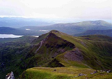
Looking south along the Cuillin ridge to Sgùrr nan Eag
|
|
| Highest point | |
| Elevation | 924 m (3,031 ft) |
| Prominence | 131 m (430 ft) |
| Parent peak | Sgùrr Dubh an Da Bheinn |
| Listing | Munro |
| Naming | |
| English translation | peak of the notches |
| Language of name | Gaelic |
| Geography | |
| Parent range | Cuillin |
| OS grid | NG457195 |
| Topo map | OS Landranger 32 Explorer 411 |
| Climbing | |
| Easiest route | Scramble up Coir' a' Grunnda |
Sgùrr nan Eag is a mountain in Scotland. It stands tall at 924 meters (about 3,031 feet). This makes it a Munro, which is a Scottish mountain over 3,000 feet high.
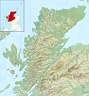
Sgùrr nan Eag is part of the amazing Cuillin mountain range. You can find it on the Isle of Skye. It's the most southern Munro along the Cuillin ridge.
Contents
Where is Sgùrr nan Eag Located?
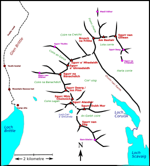
Sgùrr nan Eag is a really big mountain. It's the most southern peak in the Cuillin range that is a Munro. To its west, you'll find Loch Brittle. To the east, there's the Scavaig River. This river flows out from Loch Coruisk.
Nearby Peaks and Features
Just south-east of Sgùrr nan Eag is another peak called Gars-bheinn. This peak marks the very end of the Cuillin ridge. North of Sgùrr nan Eag is Sgùrr Dubh an Da Beinn. This peak is a "Munro Top," meaning it's a high point but not quite a full Munro itself.
The area around Sgùrr nan Eag has some cool features. To the west, there's a place called Coir' a' Ghrunnda. To the east, you'll find An Garbh-Coire. Sgùrr nan Eag might not look as dramatic as other Cuillin peaks. But it's still a huge mountain with a long, flat top!
How to Climb Sgùrr nan Eag
Climbing Sgùrr nan Eag can be an exciting adventure! One popular way to reach the top starts from Glen Brittle. You can follow a path up Coir' a' Grunnda.
Popular Climbing Routes
From Coir' a' Grunnda, you go south of Loch Coir' a' Grunnda. This leads you to the Cuillin ridge. From there, you can climb the north ridge to reach the summit. This is often considered the easiest way up.
Another option is to take the south shoulder from the coastal path. However, this route involves climbing about 2,000 feet of loose rock, which can be tiring. If you're coming from An Garbh-choire, the northeast side is tricky. But you can reach the north or east ridges with some scrambling (climbing over rocks using hands and feet).
Ridge Walking
There's also a nice and easy walk along the ridge to Gars-Bheinn. This offers great views and is a fun way to explore the area.
 | James B. Knighten |
 | Azellia White |
 | Willa Brown |


