Shadyside, Ohio facts for kids
Quick facts for kids
Shadyside, Ohio
|
|
|---|---|
|
Village
|
|

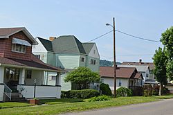
Houses on the main street
|
|

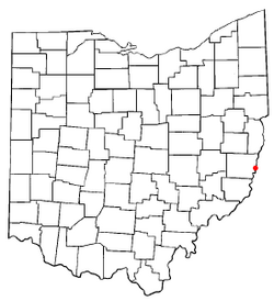
Location of Shadyside, Ohio
|
|

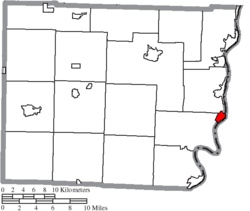
Location of Shadyside in Belmont County
|
|
| Country | United States |
| State | Ohio |
| County | Belmont |
| Area | |
| • Total | 1.03 sq mi (2.67 km2) |
| • Land | 1.01 sq mi (2.62 km2) |
| • Water | 0.02 sq mi (0.05 km2) |
| Elevation | 699 ft (213 m) |
| Population
(2020)
|
|
| • Total | 3,454 |
| • Density | 3,419.80/sq mi (1,320.06/km2) |
| Time zone | UTC-5 (Eastern (EST)) |
| • Summer (DST) | UTC-4 (EDT) |
| ZIP code |
43947
|
| Area code(s) | 740 |
| FIPS code | 39-71640 |
| GNIS feature ID | 2399790 |
Shadyside is a small village located in eastern Belmont County, Ohio. It sits right along the Ohio River. In 2020, about 3,454 people lived there. It's also part of the larger Wheeling metropolitan area.
Contents
History of Shadyside
Shadyside began in 1879 when a railroad line was built there. The town was officially planned out in 1901. The village got its name from a local farm that had many trees, giving it a "shady side."
The 1990 Flood Event
On the evening of June 14, 1990, a very heavy rainstorm hit the area. Three to six inches of rain fell in less than two hours. This caused a sudden and powerful flood in Shadyside. The flood affected Pipe Creek, Wegee Creek, and Cumberland Run. Some people said they saw a "wall of water" that was ten to thirty feet high moving quickly downstream. This event sadly caused the loss of twenty-six lives and damaged many buildings. After the flood, officials realized that the local fire departments had trouble talking to each other because they used different radio channels. This led the state to decide to build a better radio system for everyone to use.
R.E. Burger Power Station
South of Shadyside, there used to be a large power plant called the R.E. Burger Power Station. This plant used coal to make electricity. It operated for many years, from 1944 until it closed in 2011.
Geography of Shadyside
According to the United States Census Bureau, Shadyside covers a total area of about 1.03 square miles. Most of this area, about 1.01 square miles, is land. A small part, about 0.02 square miles, is water.
Population and People
| Historical population | |||
|---|---|---|---|
| Census | Pop. | %± | |
| 1920 | 3,084 | — | |
| 1930 | 4,098 | 32.9% | |
| 1940 | 4,048 | −1.2% | |
| 1950 | 4,433 | 9.5% | |
| 1960 | 5,028 | 13.4% | |
| 1970 | 5,070 | 0.8% | |
| 1980 | 4,315 | −14.9% | |
| 1990 | 3,934 | −8.8% | |
| 2000 | 3,675 | −6.6% | |
| 2010 | 3,785 | 3.0% | |
| 2020 | 3,454 | −8.7% | |
| U.S. Decennial Census | |||
Shadyside's Population in 2010
In 2010, there were 3,785 people living in Shadyside. These people made up 1,717 households, and 1,045 of these were families. The village had about 3,747 people per square mile. There were also 1,863 housing units, which are homes or apartments.
Most of the people in Shadyside were White (99.0%). A small number were African American (0.2%), Native American (0.1%), or Asian (0.2%). About 0.5% of the population identified as Hispanic or Latino.
In terms of households, about 24.1% had children under 18 living there. About 45.2% were married couples. Some households (11.5%) had a female head without a husband, and 4.1% had a male head without a wife. About 39.1% were non-family households. Many households (34.2%) had only one person living there. About 18.5% had someone living alone who was 65 years old or older. On average, a household had 2.15 people, and a family had 2.75 people.
The average age of people in the village was 47.9 years. About 17.5% of residents were under 18. About 7.3% were between 18 and 24. People aged 25 to 44 made up 21.5% of the population. Those aged 45 to 64 were 30.2%. Finally, 23.5% of residents were 65 years old or older. The village had slightly more females (54.1%) than males (45.9%).
Education in Shadyside
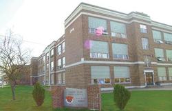
Shadyside has three schools for its students:
- Shadyside High School
- Leona Avenue Middle School
- Jefferson Elementary School
There are 853 students and 43 teachers in the school system. This means there are about 19.9 students for every teacher. The student population is mostly White (99.9%). There are slightly more female students (51%) than male students (48%).
The addresses for the schools are:
- Shadyside High School: 3890 Lincoln Avenue, Shadyside, Ohio 43947
- Leona Avenue Middle School: 3795 Leona Avenue, Shadyside, Ohio 43947
- Jefferson Elementary School: 4895 Jefferson Avenue, Shadyside, Ohio 43947
Alumni Association
The school system has a strong alumni association. This group helps the community and provides scholarships for students. They also have a fund to support academic programs in the schools and organize reunions. As of December 31, 2001, the association had 699 members.
Public Library
Shadyside also has a public library. It is a branch of the Belmont County District Library, where you can find books and other resources.
Notable People from Shadyside
- Don Fleming: A professional NFL player who played as a defensive back.
- Brad Lewis: A college quarterback who played for West Virginia University.
See also
 In Spanish: Shadyside (Ohio) para niños
 | Victor J. Glover |
 | Yvonne Cagle |
 | Jeanette Epps |
 | Bernard A. Harris Jr. |


