Shallowater, Texas facts for kids
Quick facts for kids
Shallowater, Texas
|
|
|---|---|

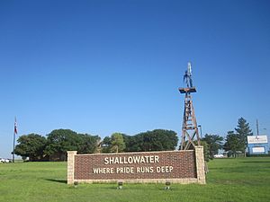
Shallowater welcome sign
|
|
| Country | |
| State | |
| County | Lubbock |
| Region | Llano Estacado |
| Established | 1909 |
| Area | |
| • Total | 1.45 sq mi (3.76 km2) |
| • Land | 1.45 sq mi (3.75 km2) |
| • Water | 0.00 sq mi (0.00 km2) |
| Elevation | 3,294 ft (1,004 m) |
| Population
(2020)
|
|
| • Total | 2,964 |
| • Density | 2,044/sq mi (788.3/km2) |
| Time zone | UTC-6 (CST) |
| ZIP code |
79363
|
| Area code | 806 |
| FIPS code | 48-67136 |
| Website | http://www.shallowatertx.us/ |
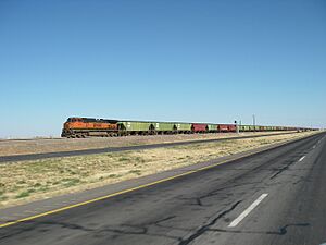
Shallowater is a small city in Lubbock County, Texas, United States. It is located about 12 miles (19 km) northwest of Lubbock. Shallowater sits along U.S. Route 84 and the Burlington Northern Santa Fe railway line. In 2020, about 2,964 people lived there. Shallowater is part of the larger Lubbock metropolitan area.
Contents
Geography of Shallowater
Shallowater is found on the high, flat lands of the Llano Estacado in Texas. This area is known for its wide-open spaces. The city covers about 1.45 square miles (3.76 square kilometers) of land. There is no water area within the city limits.
Shallowater's Climate
Shallowater has a semiarid climate. This means it is usually dry, but not a desert. It gets some rain, but not a lot. The weather can be hot in summer and mild in winter.
History of Shallowater
The story of Shallowater began in 1909. A rancher named J. C. (Jim) Bowles wanted to create a town. He worked with Bob Crump to buy land and bring a railroad through the area. On May 18, 1909, they bought the land for the new town. A school was built right away.
The Santa Fe railroad agreed to build tracks through the area after getting a payment from rancher George W. Littlefield. A company called the Ripley Townsite Company was formed to develop the town. They decided to name the new town "Shallowater" to attract people to settle there.
On June 26, 1913, a big celebration was held. This marked the official founding of the town and the completion of the railroad. At this time, the large ranches in the area were being divided into smaller farms. Cotton became a very important crop for the farmers.
During the 1920s, Shallowater grew quickly. It had many businesses, like a hotel, a lumberyard, grocery stores, and places to get gas. There were also cotton gins, which process cotton. Several churches and schools were built. The town even got a public park and a proper train station. In 1928, about 250 people lived in Shallowater.
In 1955, Shallowater officially became a city with its own local government. By the 1960s, the town had five churches, a school, a bank, a library, and a newspaper. In 1970, there were 30 businesses, including one of the biggest chicken hatcheries in the county. The population grew from 1,001 in 1960 to 1,339 in 1970. By the late 1980s, Shallowater had a post office and 17 businesses. Its population reached 2,107. It was an important center for local farms. In 2010, the population was 2,484.
People of Shallowater
| Historical population | |||
|---|---|---|---|
| Census | Pop. | %± | |
| 1960 | 1,001 | — | |
| 1970 | 1,339 | 33.8% | |
| 1980 | 1,932 | 44.3% | |
| 1990 | 1,708 | −11.6% | |
| 2000 | 2,086 | 22.1% | |
| 2010 | 2,484 | 19.1% | |
| 2020 | 2,964 | 19.3% | |
| U.S. Decennial Census | |||
2020 Census Snapshot
In 2020, there were 2,964 people living in Shallowater. These people made up 936 households and 736 families. The table below shows the different groups of people who live in Shallowater.
| Group | Number of People | Percentage |
|---|---|---|
| White (not Hispanic) | 2,080 | 70.18% |
| Black or African American (not Hispanic) | 14 | 0.47% |
| Native American or Alaska Native (not Hispanic) | 20 | 0.67% |
| Asian (not Hispanic) | 2 | 0.07% |
| Some Other Group (not Hispanic) | 28 | 0.94% |
| Mixed/Multi-Racial (not Hispanic) | 68 | 2.29% |
| Hispanic or Latino | 752 | 25.37% |
| Total | 2,964 |
Schools in Shallowater
Students in Shallowater attend schools in the Shallowater Independent School District. The schools are well-known for their sports teams. In 2004, both the boys' and girls' basketball teams won state championships!
Churches in Shallowater
Shallowater has five churches that serve the community:
- First Baptist Church Shallowater
- New Hope Community Church
- Shallowater United Methodist Church
- St. Philip Catholic Church
- Twelfth Street Church of Christ
These churches often come together once a year for a special Thanksgiving service for everyone in the community.
See also
 In Spanish: Shallowater (Texas) para niños
 | Georgia Louise Harris Brown |
 | Julian Abele |
 | Norma Merrick Sklarek |
 | William Sidney Pittman |


