Sharpsburg, Iowa facts for kids
Quick facts for kids
Sharpsburg, Iowa
|
|
|---|---|
 |
|

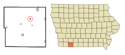
Location of Sharpsburg, Iowa
|
|
| Country | |
| State | |
| County | Taylor |
| Area | |
| • Total | 0.36 sq mi (0.94 km2) |
| • Land | 0.36 sq mi (0.92 km2) |
| • Water | 0.01 sq mi (0.02 km2) |
| Elevation | 1,286 ft (392 m) |
| Population
(2020)
|
|
| • Total | 72 |
| • Density | 202.25/sq mi (78.04/km2) |
| Time zone | UTC-6 (Central (CST)) |
| • Summer (DST) | UTC-5 (CDT) |
| ZIP code |
50862
|
| Area code(s) | 641 |
| FIPS code | 19-72075 |
| GNIS feature ID | 2395859 |
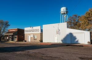
Sharpsburg is a small city located in Taylor County, Iowa, in the United States. In 2020, the population of Sharpsburg was 72 people.
Contents
History of Sharpsburg
Sharpsburg was started in 1884. It was a stop along the Chicago, Burlington and Quincy Railroad, which was a very important train line at the time.
A post office, where people could send and receive mail, was opened in Sharpsburg in 1886. The city officially became an incorporated city in 1905. This meant it could have its own local government.
Geography and Location
Sharpsburg is located in Iowa, a state in the central United States.
Land and Water Area
According to the United States Census Bureau, the city covers a total area of about 0.37 square miles (0.96 square kilometers). Most of this area, about 0.36 square miles (0.93 square kilometers), is land. A very small part, about 0.01 square miles (0.026 square kilometers), is water.
Population and People
This section looks at how many people live in Sharpsburg and some facts about them.
| Historical populations | ||
|---|---|---|
| Year | Pop. | ±% |
| 1910 | 181 | — |
| 1920 | 188 | +3.9% |
| 1930 | 182 | −3.2% |
| 1940 | 173 | −4.9% |
| 1950 | 147 | −15.0% |
| 1960 | 130 | −11.6% |
| 1970 | 106 | −18.5% |
| 1980 | 114 | +7.5% |
| 1990 | 116 | +1.8% |
| 2000 | 98 | −15.5% |
| 2010 | 89 | −9.2% |
| 2020 | 72 | −19.1% |
| Source: and Iowa Data Center Source: |
||
Sharpsburg Population in 2020
In 2020, the census counted 72 people living in Sharpsburg. There were 24 households, which are groups of people living together in one home. Out of these, 17 were families.
The city had a population density of about 202 people per square mile (78 people per square kilometer). This means that for every square mile of land, there were about 202 people.
Most of the people in Sharpsburg were White (87.5%). About 12.5% of the population identified as Hispanic or Latino.
Households and Age in 2020
About 20.8% of households had children under 18 living with them. Many households (45.8%) were married couples living together.
The average age of people in Sharpsburg was 40.5 years old. About 26.4% of residents were under 20 years old. Also, 19.4% of residents were 65 years old or older. Slightly more than half of the population (54.2%) was male, and 45.8% was female.
Sharpsburg Population in 2010
In 2010, the census recorded 89 people living in Sharpsburg. There were 35 households. The population density was about 247 people per square mile (95 people per square kilometer).
Most of the people were White (98.9%). About 5.6% of the population was Hispanic or Latino.
Households and Age in 2010
In 2010, 28.6% of households had children under 18. About 48.6% of households were married couples.
The average age in the city was 38.5 years. About 25.8% of residents were under 18 years old. About 20.2% of residents were 65 years old or older. The population was 56.2% male and 43.8% female.
Education
Sharpsburg is part of the Lenox Community School District. This means students living in Sharpsburg attend schools within this district.
See also
 In Spanish: Sharpsburg (Iowa) para niños

