Shaw Island facts for kids
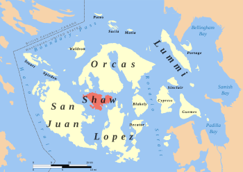
Location of Shaw Island in the San Juans
|
|
| Geography | |
|---|---|
| Location | Pacific Northwest |
| Coordinates | 48°34′24″N 122°57′26″W / 48.5732°N 122.9573°W |
| Archipelago | San Juan Islands |
| Area | 7.7037 sq mi (19.952 km2) |
| Administration | |
|
United States
|
|
| State | Washington |
| County | San Juan County |
| Demographics | |
| Population | 240 (2010) |
Shaw Island is the smallest of the four main San Juan Islands in Washington State. Ferries from the state serve these islands. The island covers about 19.952 square kilometers (7.7037 square miles).
Around 188 people live on Shaw Island all year, based on the 2020 census. In the summer, more people visit, including other residents and tourists.
Contents
Island History
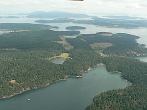
Shaw Island is part of the traditional lands of the Lummi Nation. The United States gained control of Shaw Island and the other San Juan Islands through a treaty in 1855. However, the Lummi people kept certain rights, like fishing, which are important to their culture.
In 1841, the Wilkes Expedition named the island after John Shaw, a United States Naval Officer. The Lummi Nation's hereditary chief, Bill Tsilixw James, says the Lummi people call the island Sq'emenen.
In 2015, a resident suggested renaming "Squaw Bay" to "Sq'emenen Bay." The Shaw Island Historical Society then suggested "Reef Net Bay." This name honors the traditional reef net fishing done there. The name "Reef Net Bay" was chosen.
Nuns on the Island
Shaw Island has been home to three groups of nuns from the Roman Catholic Church.
- In the 1970s, Benedictine nuns started a monastery on 150 acres.
- Since the 1980s, the Sisters of Mercy have had a private retreat there.
- Nuns from the Franciscan Sisters of the Eucharist managed the island's only store and the ferry terminal. They did this for almost 30 years until they moved in 2004.
Island Life and Places
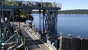
Shaw Island has a county park, a historic general store, and a post office. All these are located near the ferry landing. There is also a library and a historical museum near the center of the island. These are supported by members of the community.
The University of Washington owns land across the island. One important area is the Cedar Rock Preserve. This land was given to the university by Robert H. Ellis, Jr. The university aims to protect and restore nature there. They also use these areas for education and research.
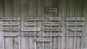
The best place to reach the shoreline is at Shaw Island County Park. It has a large beach. Shaw Island has about 11.5 miles (18.5 km) of paved roads. It also has 2.37 miles (3.81 km) of gravel public roads. The main roads form three loops in the middle of the island. Other roads lead to the ferry dock, the county park, and Neck Point.
Arts and Culture
Historic Buildings
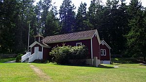
Shaw Island School District #10 has a historic one-room school that is still in use. It teaches students from kindergarten through eighth grade. This school is known as the Little Red Schoolhouse. It was built in 1891 and has been used continuously since then. This makes it the longest-running school in Washington State. The building is listed on the U.S. National Register of Historic Places.
Shaw Island also has a small library and a historical museum. These are funded by local members.
Shaw Island in Pop Culture
Shaw Island was featured in an episode of the TV show The West Wing. The episode was called "Access." In the story, it was the location of a standoff between people suspected of terrorism and the U.S. government.
The island was also mentioned in the movie "Glory."
Visiting Shaw Island
Businesses that serve tourists must help keep the island's rural and farming feel. This is part of the Shaw Subarea Plan. This plan guides how the island grows. It includes rules for places like hotels, restaurants, and boat docks.
See also
 In Spanish: Isla Shaw para niños
 | Ernest Everett Just |
 | Mary Jackson |
 | Emmett Chappelle |
 | Marie Maynard Daly |


