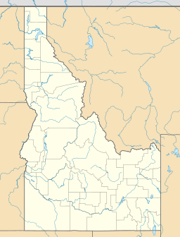
Sheep Lake facts for kids
Quick facts for kids Sheep Lake |
|
|---|---|
| Location | Custer County, Idaho |
| Coordinates | 44°06′49″N 114°36′35″W / 44.113590°N 114.609613°W |
| Type | Glacial |
| Primary outflows | Bighorn Creek to Big Boulder Creek to East Fork Salmon River |
| Basin countries | United States |
| Max. length | 290 m (950 ft) |
| Max. width | 200 m (660 ft) |
| Surface elevation | 3,015 m (9,892 ft) |
Sheep Lake is a beautiful alpine lake found in Custer County, Idaho, United States. It is located high up in the White Cloud Mountains, which are part of the amazing Sawtooth National Recreation Area.
This lake is a great spot for adventurers. You can reach it by following Sawtooth National Forest trail 601.
Contents
Where Is Sheep Lake Located?
Sheep Lake is nestled among several important natural landmarks. It sits just south of a peak called Calkins Peak. To its northeast, you'll find D. O. Lee Peak.
Water Flow and Nearby Lakes
Water flows out of Sheep Lake into Bighorn Creek. This creek then joins Big Boulder Creek, which eventually flows into the East Fork Salmon River.
Sheep Lake also has two other lakes upstream from it: Slide Lake and Neck Lake. This means water from those lakes flows down into Sheep Lake.
How Was Sheep Lake Formed?
Sheep Lake is a type of lake known as a glacial lake. This means it was formed a very long time ago by glaciers.
The Power of Glaciers
Glaciers are like giant, slow-moving rivers of ice. As they move across the land, they pick up rocks and soil. This process carves out deep hollows and valleys in the earth. When the glaciers melt, these hollows fill with water, creating lakes like Sheep Lake.
High Elevation Lakes
Sheep Lake is located at a high elevation of 3,015 m (9,892 ft) (about 9,892 feet) above sea level. Many glacial lakes are found in high mountain areas because that's where glaciers were once very active.
 | Sharif Bey |
 | Hale Woodruff |
 | Richmond Barthé |
 | Purvis Young |


