Shelbourne Road facts for kids
| Bóthar Shíol Bhroin (Irish) | |
| Former name(s) | Artichoke Road, Beggar's Bush Road |
|---|---|
| Namesake | William Petty, 2nd Earl of Shelburne |
| Length | 900 m (3,000 ft) |
| Width | 19 metres (62 ft) |
| Location | Ballsbridge, Dublin, Ireland |
| Postal code | D04 |
| Coordinates | 53°20′02″N 6°13′55″W / 53.33401°N 6.231969°W |
| north end | Merrion Road |
| south end | Bath Avenue, Haddington Road, Grand Canal Street Upper |
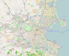
Shelbourne Road (which in Irish is Bóthar Shíol Bhroin) is a road in Ballsbridge. This area is in the southeast part of Dublin, Ireland.
Contents
What's in a Name? The History of Shelbourne Road
Shelbourne Road has had a few different names over the years. Old maps help us learn about its past.
From Beggars' Bush to Artichoke Road
In a map from 1756 by John Rocque, Shelbourne Road and Upper Grand Canal Street were called Beggars' Bush Road. Later, in 1793, Wilson's Plan showed the road had changed its name to Artichoke Road.
Why "Artichoke Road"? Some people say it was named after a French person named John Villiboise. In 1736, he rented some land and planted artichokes next to his house. This house became known as Artichoke House. Because of the house, the road eventually got the name Artichoke Road.
The area called Beggars' Bush was not very clear on early maps. It seemed to be around where the Lansdowne Road rugby stadium is today. By 1827, people used both "Artichoke" and "Beggars Bush road" to describe it. Even in the 1860s, "Artichoke Road" was still used. Interestingly, the house numbers used to go in the opposite direction! For example, what was No. 2 Artichoke Road is now No. 68 Shelbourne Road.
How Did Shelbourne Road Get Its Name?
In 1876, an official map called the road Shelburne Road. This name came from William Petty-Fitzmaurice. He was also known as the Marquess of Lansdowne. He was born in Dublin and was even the Prime Minister of the United Kingdom from 1782 to 1783.
You might notice that the old name "Shelburne" is spelled with a "u," but today it's "Shelbourne" with an "o." It's not clear how the spelling changed. Another place, Shelburne Falls, Massachusetts, which was also named after William Petty-Fitzmaurice, still uses the original "u" spelling.
Where is Shelbourne Road Located?
Shelbourne Road starts in the north at Haddington Road. It then goes southeast, passing by where the old Beggars Bush Barracks used to be. The road crosses Lansdowne Road right next to the famous international rugby union and football grounds. From there, it goes southwest until it meets Merrion Road at the River Dodder bridge.
From Marshland to Modern Road
Early maps show that Shelbourne Road followed the edge of the Dodder river's marshy area. This area was often flooded by the tide. People started to reclaim this land in 1713. But a big change happened in 1792 when William Vavasour rented a large area of marshland. He planned to build banks along the Dodder river to stop the flooding. This helped the area look more like it does today.
More drainage work was done in the 1830s for the Dublin and Kingstown Railway line. Even today, when people dig for building work along the road, they sometimes find oyster and mussel shells. This is a cool reminder that the sea used to be much closer!
Famous People and Places Connected to Shelbourne Road
Shelbourne Road has some interesting connections to famous people and important places.
James Joyce and Bloomsday
In 1904, the famous writer James Joyce lived for a short time at No. 60 Shelbourne Road. On June 16, 1904, he went on a date with Nora Barnacle, who later became his wife. This date was so special to him that he chose it as the day his famous novel, Ulysses, takes place. Now, June 16 is celebrated every year as 'Bloomsday'.
In one of Joyce's short stories, Counterparts, a character named Farrington gets off a tram at Shelbourne Road. He walks home along the barracks wall, possibly to No. 60 Shelbourne Road.
Trinity College's Botanic Gardens
Where the Berkeley Court and Jurys hotels stand today, there used to be Trinity College's Botanic Gardens. This large piece of land was sold for a huge amount of money in 2005. This made that corner of Shelbourne Road one of the most expensive places in Europe!
Richard Turner and His Ironworks
Richard Turner was famous for building the beautiful glasshouse at the Irish National Botanic Gardens. In 1834, he built his own factory, called Hammersmith Ironworks, at the southern end of Shelbourne Road. It was right next to Trinity College's Botanic Gardens. Many parts of the railings around Trinity College were made at his factory.
Turner also built houses for his workers near his factory. These houses were called Turner's Cottages. They were two-story buildings, and there were 24 of them in 1901. People nicknamed them The Gut. These cottages were around until the early 1970s.
Swastika Laundry
The Swastika Laundry was a laundry business started in 1912 on Shelbourne Road. They used electric vans to pick up and deliver laundry. These vans were red with a black swastika symbol on a white background. This symbol was used by many cultures around the world for good luck before it was taken over by the Nazi party.
Shelbourne Football Club
Shelbourne Football Club was started in 1895. The founders decided on the name by flipping a coin under the Bath Avenue railway bridge. It was either going to be Bath FC or Shelbourne FC! The club played in a few different places over the years. Now, Shelbourne FC plays on the northside of Dublin at Tolka Park.
 | DeHart Hubbard |
 | Wilma Rudolph |
 | Jesse Owens |
 | Jackie Joyner-Kersee |
 | Major Taylor |


