Shenley River facts for kids
Quick facts for kids Shenley River |
|
|---|---|

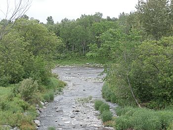
Shenley River towards the point of confluence with the Chaudière River.
|
|
| Native name | Rivière Shenley |
| Country | Canada |
| Province | Quebec |
| Region | Chaudière-Appalaches |
| MRC | Beauce-Sartigan Regional County Municipality |
| Physical characteristics | |
| Main source | Agricultural and forest streams Saint-Honoré-de-Shenley 438 metres (1,437 ft) 45°59′08″N 70°47′40″W / 45.985585°N 70.794492°W |
| River mouth | Chaudière River Saint-Martin 226 metres (741 ft) 45°56′44″N 70°39′19″W / 45.94556°N 70.65527°W |
| Length | 12.3 kilometres (7.6 mi) |
| Basin features | |
| Progression | Chaudière River, St. Lawrence River |
| River system | St. Lawrence River |
| Tributaries |
|
The Shenley River is a river in Quebec, Canada. It's also known as rivière Shenley in French. This river flows into the Chaudière River. The Chaudière River then flows north into the mighty St. Lawrence River.
The Shenley River passes through two towns: Saint-Honoré-de-Shenley and Saint-Martin. It is located in the Beauce-Sartigan Regional County Municipality. This area is part of the Chaudière-Appalaches region in Quebec, Canada.
Contents
Where the Shenley River Flows
A river's watershed is the area of land where all the water drains into that river. Here are the main watersheds near the Shenley River:
- North side: Roy brook, Dutil brook, Pozer River, Chaudière River
- East side: Chaudière River
- South side: rivière de la Grande Coudée, Petit Portage River
- West side: Toinon River, Le Petit Shenley, Bras Saint-Victor
Where the River Starts
The Shenley River begins from several small streams. These streams collect water from the area south of Vaseux Lake. This is northeast of the village of Saint-Honoré-de-Shenley.
The river's starting point is about 3.6 kilometres (2.2 mi) northeast of the center of Saint-Honoré-de-Shenley. It is also 2.5 kilometres (1.6 mi) north of Route 269. This spot is south of the village of Saint-Benoît-Labre.
The River's Journey
From its source, the Shenley River flows for about 12.3 kilometres (7.6 mi). Here's how its journey is divided:
- It flows 0.3 kilometres (0.19 mi) towards the southeast. It crosses the 4th Rang Nord road. This crossing is 2.4 kilometres (1.5 mi) north of Route 269.
- Next, it flows 3.5 kilometres (2.2 mi) southeast. It reaches an old country road. It crosses this road 0.9 kilometres (0.56 mi) south of Route 269.
- Then, it travels 3.9 kilometres (2.4 mi) southeast. It flows to the 2nd Rang de Shenley North.
- Finally, it flows 4.6 kilometres (2.9 mi) southeast. It crosses Route 269 and 4th Rue West. This is where it meets the Chaudière River.
Where the River Ends
The Shenley River joins the Chaudière River on its west bank. This meeting point is in the town of Saint-Martin.
This spot is about 1.4 kilometres (0.87 mi) upstream from the bridge in Saint-Martin village. It is also downstream from the village of Saint-Gédéon-de-Beauce.
What's in a Name?
The name "Shenley River" was officially recognized on December 5, 1968. This was done by the Commission de toponymie du Québec. This commission is in charge of naming places in Quebec.
 | Madam C. J. Walker |
 | Janet Emerson Bashen |
 | Annie Turnbo Malone |
 | Maggie L. Walker |


