Shinall Mountain facts for kids
Quick facts for kids Shinall Mountain |
|
|---|---|
 |
|
| Highest point | |
| Elevation | 1,068 ft (326 m) NAVD 88 |
| Geography | |
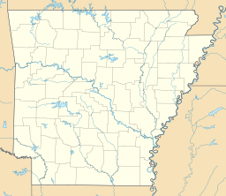
| Location | Pulaski County, Arkansas, U.S. |
| Parent range | Ouachita Mountains, U.S. Interior Highlands |
| Topo map | USGS Pinnacle Mountain |
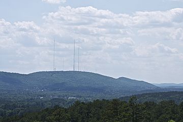
Shinall Mountain is the highest natural point in Pulaski County, Arkansas. It is home to many broadcast towers. The bright lights on these towers can be seen for miles around! This mountain is located near Little Rock, the capital and largest city in Arkansas. It sits in the foothills of the Ouachita Mountains.
What's in a Name?
The name "Shinall" is often misspelled as "Chenal." Both words sound the same. "Shinall" comes from the French name "Chenault." A family with this name settled near the mountain before the American Civil War.
The name "Chenal" is used for a large community nearby. This community is called Chenal Valley. It is a planned neighborhood in west Little Rock. Chenal Parkway is a road that goes up Shinall Mountain. It connects two highways, Highway 10 and Highway 300, to Little Rock's main business area. The company that built Chenal Valley chose the name "Chenal" to make it sound special.
Where is Shinall Mountain?
Shinall Mountain is about three miles south of Pinnacle Mountain. Pinnacle Mountain looks taller because it is steeper. However, Shinall Mountain is actually 55 feet higher!
According to the Geographic Names Information System (GNIS), Shinall Mountain is a summit. A summit is the highest point of a mountain or hill.
 | Bayard Rustin |
 | Jeannette Carter |
 | Jeremiah A. Brown |


