Shootflying Hill facts for kids
Quick facts for kids Shootflying Hill |
|
|---|---|
| Highest point | |
| Elevation | 52 ft (16 m) |
| Geography | |
| Location | Cape Cod, Massachusetts |
| Topo map | USGS Hyannis |
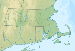
Shootflying Hill is a small natural rise located in Barnstable County, Massachusetts. It is found on Cape Cod, a famous peninsula in the state. This hill sits just north of the village of Centerville. It is part of the larger Town of Barnstable.
Contents
About Shootflying Hill
Shootflying Hill is a low elevation point in Massachusetts. It is sometimes called a "mountain" even though it is quite small. The hill is 52 feet (about 16 meters) high. It is located in a beautiful area of Cape Cod.
Where is Shootflying Hill?
This hill is in the eastern part of Massachusetts. It is specifically located in Barnstable County. You can find it north of Centerville, which is a village within the Town of Barnstable. The area around the hill is known for its natural beauty.
How Did Shootflying Hill Get Its Name?
The name Shootflying Hill comes from an old practice. Long ago, people used to hunt geese and ducks in this area. They would shoot the birds as they flew over the hill. This activity gave the hill its unique name.
Nearby Hills
Shootflying Hill is not alone in its area. There are other similar natural rises nearby. To the west of Shootflying Hill, you can find Clay Hill. To the east-northeast, there is another rise called Cobbs Hill. These hills are all part of the natural landscape of Cape Cod.


