Clay Hill (Massachusetts) facts for kids
Quick facts for kids Clay Hill |
|
|---|---|
| Highest point | |
| Elevation | 194 ft (59 m) |
| Geography | |
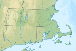
| Location | Cape Cod, Massachusetts |
| Topo map | USGS Hyannis |
Clay Hill is a natural rise in the land located in Barnstable County, Massachusetts. Even though it's called a "hill," it's sometimes referred to as a "mountain" in local records, which can be a bit confusing! It's a quiet spot that's part of the beautiful landscape of Cape Cod.
Contents
What is Clay Hill?
Clay Hill is a small, rounded landform. It stands out in the mostly flat areas of Cape Cod. While it might not be a towering peak like those in other parts of the world, it's an important part of the local geography and environment.
Where is Clay Hill Located?
You can find Clay Hill about 1.8 miles (or about 2.9 kilometers) south-southeast of a town called West Barnstable. It's part of the larger Town of Barnstable area. If you look on a map, you'll see it's quite close to the coast of Cape Cod.
Other interesting hills are nearby too! Shootflying Hill is located to the east of Clay Hill. To the north, you'll find White Hill. These hills together create a unique landscape in this part of Massachusetts.
How High is Clay Hill?
Clay Hill reaches an elevation of 194 feet (which is about 59 meters) above sea level. This makes it one of the higher points in the immediate area. Knowing its elevation helps us understand how high it stands compared to the surrounding land.
Exploring the Area Around Clay Hill
The area around Clay Hill is known for its natural beauty. Cape Cod is famous for its beaches, forests, and unique wildlife. While Clay Hill itself might not have marked trails, the surrounding region offers many opportunities for outdoor activities. These can include hiking, bird watching, or simply enjoying nature. It's a great place to explore if you're interested in the local environment and geology.


