Shrewsbury, Missouri facts for kids
Quick facts for kids
Shrewsbury, Missouri
|
|
|---|---|
 |
|

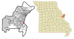
Location of Shrewsbury, Missouri
|
|
| Country | United States |
| State | Missouri |
| County | St. Louis |
| Area | |
| • Total | 1.44 sq mi (3.73 km2) |
| • Land | 1.44 sq mi (3.73 km2) |
| • Water | 0.00 sq mi (0.00 km2) |
| Elevation | 522 ft (159 m) |
| Population
(2020)
|
|
| • Total | 6,406 |
| • Density | 4,445.52/sq mi (1,716.09/km2) |
| Time zone | UTC-6 (Central (CST)) |
| • Summer (DST) | UTC-5 (CDT) |
| FIPS code | 29-67700 |
| GNIS feature ID | 2395878 |
Shrewsbury is a city located near St. Louis in St. Louis County, Missouri, United States. It is often called an "inner-ring suburb" because it's close to a larger city. In 2020, about 6,406 people lived there.
Contents
History of Shrewsbury
Shrewsbury was officially planned out in 1889. The land where Shrewsbury now stands was once owned by Gregorie Sarpy and Charles Gratiot Sr.. By 1890, it was divided into farms and sold to different families.
A large farm of about 278 acres belonged to General John Murdoch. He named his farm Shrewsbury Park, after a town in England. This is how the area got its name.
Becoming a Village
In 1913, a local resident named Joseph Burge started the Shrewsbury Improvement Association. Their goal was to make Shrewsbury a better place to live. They worked to create the city's first sewer system.
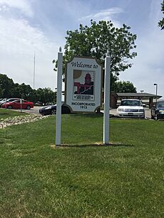
Shrewsbury officially became a village in 1913. Soon after, a new sanitation system was built. This helped to reduce diseases that were common at the time.
Growth and Development
In 1938, the United States government helped Shrewsbury financially. Land was bought to build a new city hall. This new building was finished in October 1938. It replaced the original one from 1912.
Shrewsbury got a new fire engine house and modern equipment in 1947. During this time, the Shrewsbury Garden Club was formed. They helped keep the city's trees and flowers beautiful.
In the early 1950s, public bus routes expanded. This made it easier to travel between Shrewsbury and St. Louis. The 1960s and 1970s saw a lot of community growth. New city parks and a swimming pool were built. Interstate 44, a major highway, was also constructed.
Modern Shrewsbury
The 1980s and 1990s brought more new homes, apartments, and shopping areas. A new and improved City Center opened on May 8, 1993. This opening celebrated Shrewsbury's 80th year as an incorporated city.
The old City Hall building became the Public Safety Building. It now houses the police and fire departments.
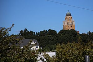
In 2006, a new MetroLink train station was completed. This station connects Shrewsbury to the St. Louis light rail system. Shrewsbury is also home to the Kenrick–Glennon Seminary. This is a school for people studying to become Roman Catholic priests.
Geography of Shrewsbury
Shrewsbury covers a total area of about 1.43 square miles (3.73 square kilometers). All of this area is land.
The city has clear boundaries with its neighbors:
- To the east is St. Louis.
- To the north is Webster Groves.
- To the west is Marlborough.
- To the south are Mackenzie and Affton.
Children living in Shrewsbury attend schools in the Webster Groves and Affton school districts.
Population Information
| Historical population | |||
|---|---|---|---|
| Census | Pop. | %± | |
| 1920 | 845 | — | |
| 1930 | 1,525 | 80.5% | |
| 1940 | 2,182 | 43.1% | |
| 1950 | 3,382 | 55.0% | |
| 1960 | 4,730 | 39.9% | |
| 1970 | 5,896 | 24.7% | |
| 1980 | 5,077 | −13.9% | |
| 1990 | 6,416 | 26.4% | |
| 2000 | 6,644 | 3.6% | |
| 2010 | 6,254 | −5.9% | |
| 2020 | 6,406 | 2.4% | |
| U.S. Decennial Census | |||
Population in 2020
In 2020, the city of Shrewsbury had 6,406 people living there.
Population in 2010
According to the census of 2010, there were 6,254 people in Shrewsbury. There were 3,218 households, which are groups of people living together. About 1,331 of these households were families.
The population density was about 4,373 people per square mile. This means many people live in a small area. There were also 3,487 housing units, like houses or apartments.
Most residents (90.4%) were White. Other groups included African American (3.6%), Asian (3.9%), and people of two or more races (1.4%). About 2.3% of the population was Hispanic or Latino.
About 16.3% of households had children under 18. Many households (50%) were made up of individuals living alone. About 23.3% of these individuals were 65 years old or older. The average age in the city was 42.9 years.
Getting Around Shrewsbury
Public Transportation
Shrewsbury is served by the Blue Line of the St. Louis light rail system. This is a train system that helps people travel around the region.
The city has one station called Shrewsbury–Lansdowne I-44. Even though it's named for Shrewsbury, it's actually located just outside the city limits in St. Louis.
Metro Transit also runs the Shrewsbury Transit Center. This center connects the train station to several MetroBus routes. These buses help people get to different parts of the city and beyond.
Major Roads
Several important roads pass through Shrewsbury. These include Big Bend Boulevard, Laclede Station Road, Lansdowne Avenue, Murdoch Avenue, and Watson Road.
Interstate 44, a major highway, also goes through the northern part of the city. It is near an area called Deer Creek.
See also
 In Spanish: Shrewsbury (Misuri) para niños
 | Janet Taylor Pickett |
 | Synthia Saint James |
 | Howardena Pindell |
 | Faith Ringgold |


