Shutdown Mountain (Maine) facts for kids
Quick facts for kids Shutdown Mountain |
|
|---|---|
| Highest point | |
| Elevation | 2,539 ft (774 m) |
| Prominence | 939 ft (286 m) |
| Geography | |
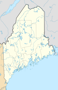
| Location | Somerset County, Maine, U.S. |
| Topo map | USGS Enchanted Pond |
Shutdown Mountain is a mountain found in Somerset County, Maine. It's a cool place to explore in the U.S..
Contents
What is Shutdown Mountain?
Shutdown Mountain is a mountain with two main tops. One is called Shutdown Peak. The other is Bulldog Peak, which is about 2,260 feet high. People sometimes call Bulldog Peak "Bulldog Mountain."
Where Does the Water Go?
The water from Shutdown Mountain flows into the Kennebec River. This is called a watershed.
- The north and south sides of the mountain send water into Enchanted Stream.
- Enchanted Stream then flows into the Dead River.
- The Dead River is a smaller river that joins the Kennebec River.
- Water from the west side of Shutdown Mountain goes into Stony Brook.
- Stony Brook also flows into the Dead River.
- The east side of the mountain drains into Enchanted Pond.
- From Enchanted Pond, the water goes into Enchanted Stream and then into the Dead River.
Exploring Shutdown Mountain
There is a special path for hikers on Shutdown Mountain. It's called "Enchanted Lookout." This trail leads to the top of Bulldog Peak.
Hiking to Bulldog Peak
Bulldog Peak stands tall, about 817 feet above the land around it. From the top, you can see amazing views of Enchanted Pond.
- The start of the hiking path is at a place called Bulldog Camps.
- Bulldog Camps is a traditional Maine sporting camp.
- It is located on the north shore of Enchanted Pond.
- Sporting camps are places where people stay to enjoy outdoor activities.
Black History Month on Kiddle
Famous African-American Architects:
 | Calvin Brent |
 | Walter T. Bailey |
 | Martha Cassell Thompson |
 | Alberta Jeannette Cassell |

All content from Kiddle encyclopedia articles (including the article images and facts) can be freely used under Attribution-ShareAlike license, unless stated otherwise. Cite this article:
Shutdown Mountain (Maine) Facts for Kids. Kiddle Encyclopedia.

