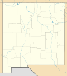
Sierra Aguilada facts for kids
Quick facts for kids Sierra Aguilada |
|
|---|---|
| Highest point | |
| Peak | Brushy Mountain (Aguilada Mountains) |
| Elevation | 7,405 ft (2,257 m) |
| Dimensions | |
| Length | 15 mi (24 km) SW-NE |
| Width | 9 mi (14 km) E-W-(variable) |
| Geography | |
| Country | United States |
| State | New Mexico |
| Region | (east)-White Mountains (Arizona) ((east)-Transition zone) |
| District | Catron County, New Mexico |
| Settlement | Glenwood–Pleasanton |
| Range coordinates | 33°18′15″N 108°56′00″W / 33.30417°N 108.93333°W |
| Borders on | San Francisco River–Mogollon Mountains-E Big Lue Mountains-SW San Francisco River-S-(range perimeter) Mesas-W Blue Range Wilderness-N & NW |
The Sierra Aguilada is a mountain range located in the southwestern part of Catron County, New Mexico. It sits on the eastern edge of Arizona's White Mountains.
Just to the east of Sierra Aguilada are the Mogollon Mountains in New Mexico. The San Francisco River flows south between these two mountain ranges. This river then turns west, creating the southern boundary of the Sierra Aguilada. It eventually meets the Gila River after passing northwest of the Big Lue Mountains in Arizona.
Contents
Exploring the Sierra Aguilada Range
The Sierra Aguilada mountain range is about 15 miles (24 kilometers) long. It is found in an area filled with forests and flat-topped hills called mesas.
To the east of the range are the Mogollon Mountains. This area also includes the large Gila Wilderness and Gila National Forest, which are protected natural spaces. North and northwest of the Sierra Aguilada, you'll find the Blue Range Wilderness.
Roads and Nearby Towns
U.S. Route 180 in New Mexico runs along the eastern side of the Sierra Aguilada range. This road follows a section of the San Francisco River that flows north to south.
The towns of Pleasanton and Glenwood are located along the San Francisco River. They are just east and northeast of the mountain range.
Highest Points: Peaks of the Range
The tallest peak in the Sierra Aguilada range is Brushy Mountain. It stands at about 7,405 feet (2,257 meters) high. You can find it in the north-central part of the range.
Another important peak is Park Mountain, which is close by. It reaches about 7,321 feet (2,231 meters) in height. Park Mountain is located just west of the range's center line.
See also
In Spanish: Sierra Aguilada para niños
 | Misty Copeland |
 | Raven Wilkinson |
 | Debra Austin |
 | Aesha Ash |


