Sierra Carapé facts for kids
Quick facts for kids Sierra Carapé |
|
|---|---|

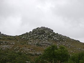
A rocky summit in this range of hills.
|
|
| Highest point | |
| Peak | Cerro Catedral (Cathedral Hill) |
| Elevation | 513.66 m (1,685.2 ft) |
| Geography | |
| Country | Uruguay |
| Range coordinates | 34°20′S 54°39′W / 34.333°S 54.650°W |
| Parent range | Cuchilla Grande |
| Geology | |
| Age of rock | Precambrian |
| Type of rock | Granite, gneiss |
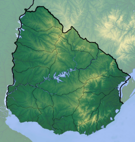
The Sierra Carapé (also called Sierra de Carapé) is a range of hills in southern Uruguay. You can find it mostly in the Maldonado Department. These hills stretch from west to east, even going into the Rocha Department.
Where is Sierra Carapé?
This hill range forms a natural border. It separates the Lavalleja Department from the Maldonado Department in south-eastern Uruguay. The Sierra Carapé is also part of a much bigger hill system. This larger system is known as the Cuchilla Grande.
Uruguay's Highest Point
The Sierra Carapé is home to the highest point in all of Uruguay. This peak is called Cerro Catedral, which means "Cathedral Hill." It stands tall at 513.66 meters (about 1,685 feet) above sea level.
More to Explore
- Geography of Uruguay
See also
 In Spanish: Sierra Carapé para niños
Black History Month on Kiddle
Famous African-American Scientists:
 | William M. Jackson |
 | Juan E. Gilbert |
 | Neil deGrasse Tyson |

All content from Kiddle encyclopedia articles (including the article images and facts) can be freely used under Attribution-ShareAlike license, unless stated otherwise. Cite this article:
Sierra Carapé Facts for Kids. Kiddle Encyclopedia.

