Cuchilla Grande facts for kids
Quick facts for kids Cuchilla Grande |
|
|---|---|

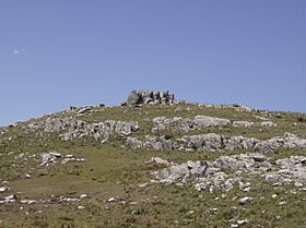
Cerro Catedral, the highest point in Uruguay.
|
|
| Highest point | |
| Peak | Cerro Catedral (Cathedral Hill) |
| Elevation | 513.66 m (1,685.2 ft) |
| Geography | |
| Country | Uruguay |
| Geology | |
| Age of rock | Precambrian |
| Type of rock | Granite, gneiss |
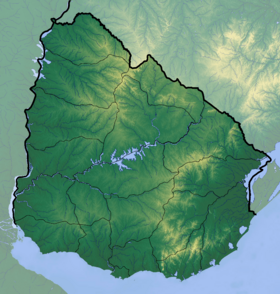
The Cuchilla Grande is a long chain of hills in Uruguay. It stretches from the north to the south, running through the eastern part of the country. This hill range starts in the southern part of the Cerro Largo Department. It then goes through the departments of Treinta y Tres and Lavalleja. Finally, it reaches the Maldonado Department, where you can find its tallest peaks.
Important Hills
The Cuchilla Grande is home to some very important hills in Uruguay.
Cerro Catedral
The Cerro Catedral is the highest point in all of Uruguay. It stands tall at 513.66 meters (about 1,685 feet) above sea level. This famous hill is located in the Maldonado Department. Its name means "Cathedral Hill" in Spanish.
Cerro Pan de Azúcar
Another well-known hill in this range is the Cerro Pan de Azúcar. It is also found in the Maldonado Department. This hill is close to the city of Piriápolis, a popular place for tourists.
Smaller Hill Ranges
The Cuchilla Grande is like a main road with smaller paths branching off it. These smaller hill ranges are also part of this large system:
- Cuchilla de Mansavillagra
- Sierra Carapé
- Sierra Aceguá
- Sierra de las Ánimas
- Cuchilla Grande Inferior
- Cuchilla de Cerro Largo
See also
 In Spanish: Cuchilla Grande (Uruguay) for kids
- Geography of Uruguay
 | Madam C. J. Walker |
 | Janet Emerson Bashen |
 | Annie Turnbo Malone |
 | Maggie L. Walker |


