Sierra de las Ánimas facts for kids
Quick facts for kids Sierra de las Ánimas |
|
|---|---|

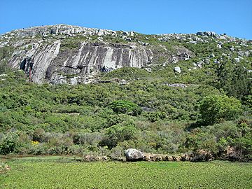
Cerro Pan de Azúcar
|
|
| Highest point | |
| Peak | Cerro de las Ánimas |
| Elevation | 501 m (1,644 ft) |
| Geography | |
| Country | Uruguay |
| Range coordinates | 34°36′S 55°17′W / 34.600°S 55.283°W |
| Geology | |
| Age of rock | Precambrian |
| Type of rock | Granite, gneiss |
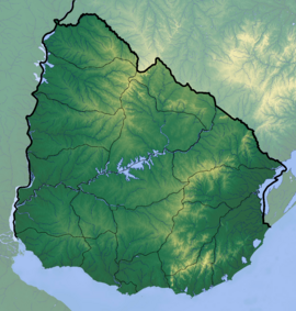
The Sierra de las Ánimas is a group of hills in Uruguay. It starts in the Lavalleja Department and stretches south into the Maldonado Department. These hills are an important part of Uruguay's natural landscape.
What Makes It Special?
In the Maldonado Department, the Sierra de las Ánimas includes one of Uruguay's highest points. This is the top of Cerro de las Ánimas, which is about 501 meters (1,644 feet) high. This peak is located near the towns of Gregorio Aznárez and Las Flores.
The Sierra de las Ánimas is unique because it is the only group of hills in Uruguay that formed from volcanoes. This means its rocks and shape were created by ancient volcanic activity. The main rocks found here are Granite and gneiss, which are very old. They formed during the Precambrian period, billions of years ago.
Part of a Bigger Picture
The Sierra de las Ánimas is actually a smaller part of a much larger system of hills. It branches off from the Cuchilla Grande. The Cuchilla Grande is a long chain of hills that goes north and northeast through the Treinta y Tres Department and into the Cerro Largo Department. This larger chain includes many other smaller hill ranges.
See also
 In Spanish: Sierra de las Ánimas para niños
- Geography of Uruguay
 | Stephanie Wilson |
 | Charles Bolden |
 | Ronald McNair |
 | Frederick D. Gregory |


