Sierra de Albarracín facts for kids
Quick facts for kids Sierra de Albarracín |
|
|---|---|

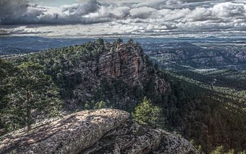
View of the Sierra de Albarracín
|
|
| Highest point | |
| Elevation | 1,856 m (6,089 ft) |
| Listing | Mountains of Aragon, List of mountains in the Valencian Community |
| Geography | |
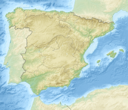
| Location | Gúdar-Javalambre, Aragon Rincón de Ademuz and Serrans, Valencian Community |
| Parent range | Iberian System, Eastern zone |
| Geology | |
| Mountain type | Shale (Late Ordovician) |
| Climbing | |
| Easiest route | From the towns of Albarracín or Monterde de Albarracín |
The Sierra de Albarracín is a mountain range in Spain. It stretches for about 28 kilometers (17 miles). This range is part of the Iberian System in the southwestern part of the country.
The highest point in the Sierra de Albarracín is a peak called Sierra Alta. It stands tall at 1,856 meters (6,089 feet) above sea level.
Contents
Exploring the Sierra de Albarracín
This mountain range gets its name from the historic town of Albarracín. This town is located high up in the mountains, at about 1,200 meters (3,937 feet). The Sierra de Albarracín also gives its name to a region in Aragon, Spain, known as the Sierra de Albarracín Comarca.
What Does the Sierra Look Like?
The Sierra de Albarracín is a rugged and wild mountain area. It has many forests filled with pine, oak, and juniper trees. You can also see large areas where the bare rock is visible.
In winter, the mountain tops are often covered in snow. The average temperature in the area is around 11 °C (52 °F). This region used to be very isolated. There were not many marked paths through its thick forests and sharp ridges.
Wildlife in the Mountains
One special creature that lives in these mountains is a type of moth called Metopoceras albarracina. This moth is endemic, meaning it is found only in this specific area and nowhere else in the world.
See also
 In Spanish: Sierra de Albarracín para niños
- Albarracín
- Monterde de Albarracín
- List of mountains in Aragon
 | May Edward Chinn |
 | Rebecca Cole |
 | Alexa Canady |
 | Dorothy Lavinia Brown |


