Silica, Kansas facts for kids
Quick facts for kids
Silica, Kansas
|
|
|---|---|

|
|
| Country | United States |
| State | Kansas |
| County | Rice |
| Township | Pioneer |
| Elevation | 1,791 ft (546 m) |
| Time zone | UTC-6 (CST) |
| • Summer (DST) | UTC-5 (CDT) |
| Area code | 620 |
| FIPS code | 20-65475 |
| GNIS ID | 484747 |
Silica is a small place in Rice County, Kansas, United States. It is an unincorporated community, which means it doesn't have its own local government like a city or town. Instead, it's part of the larger Pioneer Township.
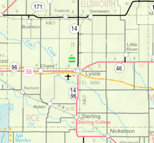
You can find Silica in the southwestern part of Pioneer Township. It's located just north of two main roads, U.S. Route 56 and K-96. Silica is about 6 miles (10 km) east of Ellinwood and 14 miles (23 km) west of Lyons.
Contents
The Story of Silica
Early Days in Kansas
For thousands of years, the land that is now Kansas was home to many different Native American tribes. These groups lived off the land and built their communities here.
In 1803, the United States bought a huge area of land, including most of modern Kansas. This big purchase was called the Louisiana Purchase. It greatly expanded the size of the United States.
Kansas Becomes a State
Later, in 1854, the area was organized as the Kansas Territory. This was a step towards becoming a state. Finally, in 1861, Kansas officially became the 34th U.S. state.
Forming Rice County
A few years after Kansas became a state, Rice County was created in 1867. This county is where Silica is located today.
Silica's Post Office
Silica once had its own post office. It opened in 1893, helping people send and receive mail. However, the post office closed its doors in 1953.
Learning in Silica
The children and young people in Silica attend schools run by the Chase–Raymond USD 401 public school district. This district provides education for students in the area.
 | Selma Burke |
 | Pauline Powell Burns |
 | Frederick J. Brown |
 | Robert Blackburn |


