Ellinwood, Kansas facts for kids
Quick facts for kids
Ellinwood, Kansas
|
|
|---|---|
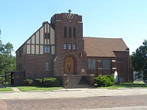
United Methodist Church (2012)
|
|
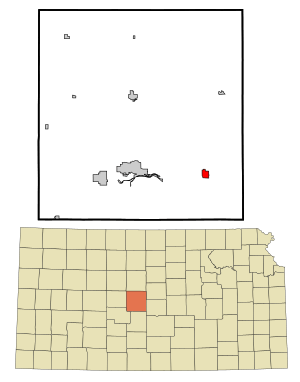
Location within Barton County and Kansas
|
|
|
|
| Country | United States |
| State | Kansas |
| County | Barton |
| Founded | 1871 |
| Incorporated | 1878 |
| Named for | Colonel John Ellinwood |
| Area | |
| • Total | 1.32 sq mi (3.42 km2) |
| • Land | 1.32 sq mi (3.42 km2) |
| • Water | 0.00 sq mi (0.00 km2) |
| Elevation | 1,788 ft (545 m) |
| Population
(2020)
|
|
| • Total | 2,011 |
| • Density | 1,523/sq mi (588.0/km2) |
| Time zone | UTC-6 (CST) |
| • Summer (DST) | UTC-5 (CDT) |
| ZIP code |
67526
|
| Area code | 620 |
| FIPS code | 20-20425 |
| GNIS ID | 475775 |
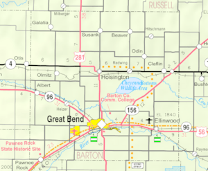
Ellinwood is a city in the southeast part of Barton County, Kansas, United States. In 2020, about 2,011 people lived there. It's a small city with a rich history.
Contents
History of Ellinwood
How Ellinwood Began (19th Century)
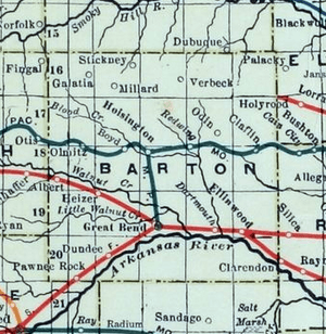
For thousands of years, the land that is now Kansas was home to Native American tribes. In 1803, the United States bought most of modern Kansas as part of the Louisiana Purchase. This was a huge land deal!
Later, in 1854, the Kansas Territory was set up. Kansas officially became the 34th U.S. state in 1861. Barton County, where Ellinwood is located, was created in 1867.
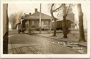
Ellinwood started in 1871. People knew the Santa Fe railroad would be built nearby. The railroad was finished in 1872. The city was named after Colonel John R. Ellinwood. He was a civil engineer who worked for the Santa Fe railroad.
Even though the first people in Ellinwood were not German, many streets got German names. This was done to attract German immigrants to buy land and settle there.
In 1878, the Atchison, Topeka and Santa Fe Railway and others started a new railway company. They built a branch line that reached Ellinwood in 1881. This line helped connect Ellinwood to other towns like Florence and McPherson.
Ellinwood in the 20th Century
Something cool happened in 1973. The famous rock band Kansas used the Ellinwood Opera House. They held a "tryout show" there for a record executive. They even offered free beer and charged a small fee to help with costs. This story is shared in a 2015 movie called Miracles Out of Nowhere.
Ellinwood in the 21st Century
Ellinwood has an annual event called the After Harvest Festival. It happens every July. In 2018, they made a new rule for the dance party. People were not allowed to bring their own coolers.
Geography and Climate
Ellinwood's Location
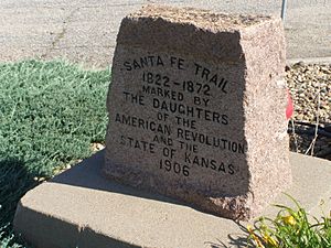
Ellinwood covers about 1.14 square miles (3.42 square kilometers). It's all land, with no large bodies of water. The city is located along the historic Santa Fe Trail. This was a very important route for trade and travel long ago.
Ellinwood is also just north of the Arkansas River. This river makes a big bend in this area. It then flows southeast towards the Mississippi River.
Weather in Ellinwood
Ellinwood has a type of weather called a humid subtropical climate. This means the summers are hot and humid. The winters are usually mild to cool.
Fun Places to Visit
- Downtown Tunnels: These are old tunnels under the city. They are fun to explore!
People of Ellinwood (Demographics)
| Historical population | |||
|---|---|---|---|
| Census | Pop. | %± | |
| 1880 | 352 | — | |
| 1890 | 684 | 94.3% | |
| 1900 | 760 | 11.1% | |
| 1910 | 976 | 28.4% | |
| 1920 | 1,103 | 13.0% | |
| 1930 | 1,115 | 1.1% | |
| 1940 | 2,059 | 84.7% | |
| 1950 | 2,569 | 24.8% | |
| 1960 | 2,729 | 6.2% | |
| 1970 | 2,416 | −11.5% | |
| 1980 | 2,508 | 3.8% | |
| 1990 | 2,329 | −7.1% | |
| 2000 | 2,164 | −7.1% | |
| 2010 | 2,131 | −1.5% | |
| 2020 | 2,011 | −5.6% | |
| U.S. Decennial Census | |||
Population in 2020
The 2020 United States census counted 2,011 people in Ellinwood. There were 862 households, which are groups of people living together. Most people in Ellinwood were White (about 93%). A small number were Black, Native American, or Asian. About 4.5% of the population identified as Hispanic or Latino.
About 29% of households had children under 18. The average household had 2.4 people. The average family had 3.0 people. The median age in Ellinwood was 41.7 years old. This means half the people were younger and half were older.
Population in 2010
In 2010, Ellinwood had 2,131 people. There were 910 households. The population density was about 1,869 people per square mile. Most people were White (96.5%). About 2.9% of the population was Hispanic or Latino.
About 29% of households had children under 18. The median age was 43.7 years. This shows that Ellinwood has a mix of age groups.
Education in Ellinwood
Students in Ellinwood attend schools in the Ellinwood USD 355 public school district.
Getting Around (Transportation)
U.S. Route 56 is a main road that goes right through the city.
Famous Person from Ellinwood
- Wally Hickel (1919–2010): He was a Governor of Alaska and also served as the Secretary of the Interior for the U.S. government.
See also
 In Spanish: Ellinwood (Kansas) para niños
 | William Lucy |
 | Charles Hayes |
 | Cleveland Robinson |


