Silva, Missouri facts for kids
Quick facts for kids
Silva
|
|
|---|---|
| Country | United States |
| State | Missouri |
| County | Wayne |
| Elevation | 404 ft (123 m) |
| Time zone | UTC-6 (Central (CST)) |
| • Summer (DST) | UTC-5 (CDT) |
| ZIP code |
63964
|
| Area code(s) | 573 |
| GNIS feature ID | 752158 |
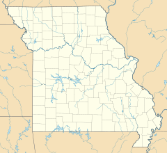
Silva is a small place in Wayne County, Missouri, in the United States. It is known as an "unincorporated community." This means it's a group of homes and businesses that isn't officially a town or city with its own local government.
Where is Silva Located?
Silva is easy to find on U.S. Route 67. It's just south of Missouri Route 34. If you're coming from Piedmont, it's about thirteen miles east. It's also only three miles north of Greenville. The community sits at the northern end of Lake Wappapello. The St. Francis River flows about one mile to the west.
A Little Bit of History
Silva has had its own post office since the year 1902. The person who was the first postmaster decided to name the community after someone she knew. That's how Silva got its unique name!
Fun Fact: Camp Lewallen
One of the most famous places in Silva is Camp Lewallen. This camp is a special place for Boy Scouts from the Greater Saint Louis Area Council. Scouts go there to learn new skills and have adventures in nature.
 | Ernest Everett Just |
 | Mary Jackson |
 | Emmett Chappelle |
 | Marie Maynard Daly |


