Simmons Island facts for kids

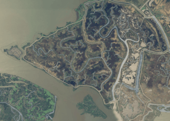
USGS aerial photo of Simmons Island
|
|
| Geography | |
|---|---|
| Location | Northern California |
| Coordinates | 38°05′49″N 121°59′26″W / 38.09694°N 121.99056°W |
| Adjacent bodies of water | Suisun Bay |
| Administration | |
| State | |
| County | Solano |
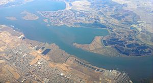
Simmons Island is a small piece of land located in Grizzly Bay, which is part of Suisun Bay in the San Francisco Bay Area of California. It's a quiet spot in Northern California, belonging to Solano County. The island is managed by a special group called Reclamation District 2127.

About Simmons Island
Simmons Island is found at these coordinates: 38°05′49″N 121°59′26″W / 38.09694°N 121.99056°W. It's a really small island, but it has been on maps for a long time.
Island's History on Maps
The island first appeared on a survey map in 1850. This map was made by a person named Cadwalader Ringgold. On his map, it was called "Simmons Island." A few years later, in 1854, another map was made by Henry Lange. On his map, the island was spelled a little differently, as "Simons Island." These old maps help us track how places were known in the past.
 | Roy Wilkins |
 | John Lewis |
 | Linda Carol Brown |


