Sleeping Giant Wilderness Study Area facts for kids
Quick facts for kids Sleeping Giant Wilderness Study Area |
|
|---|---|
| Location | Montana, U.S. |
| Nearest city | Helena, Montana |
| Area | 6,666 acres (2,698 ha) |
| Established | 1981 (first designation; de-designated in 1982); 1985 (re-designation) |
| Governing body | Bureau of Land Management |
The Sleeping Giant Wilderness Study Area is a special outdoor place in Montana, U.S.. It's a large area where people can enjoy nature without cars or noisy machines. This wilderness area is about 30 miles north of Helena, Montana. It sits on the west side of the Missouri River and Holter Lake.
This protected land was first set aside in 1981. It covers about 6,666 acres, which is like 5,000 football fields! Most of this land has no roads, and about half of it is covered in forests. A famous path, the Lewis and Clark National Historic Trail, even runs through part of it.
Contents
What is a Wilderness Study Area?
Have you ever wondered what a "wilderness study area" is? These are places the government protects. They are wild lands that might become official "Wilderness Areas" one day. The Bureau of Land Management (BLM) looks after these spots.
To be a wilderness study area, the land must be mostly untouched by humans. It needs to be at least 5,000 acres in size. These areas offer chances for quiet outdoor fun, like hiking or camping. They often have special plants, animals, rocks, or beautiful views. Until the United States Congress decides if an area becomes a full Wilderness Area, the BLM manages it carefully. They make sure it stays wild and natural.
Exploring the Sleeping Giant Area
Discovering the Sleeping Giant's Landscape
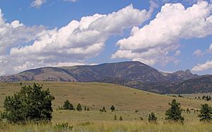
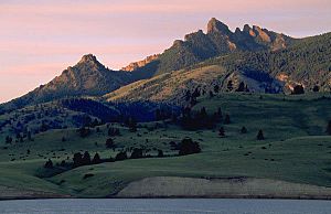
The Sleeping Giant area is shaped like a rectangle. It has Interstate 15 on its west side and Holter Lake on its east. This area is named after a famous rock formation called the "Sleeping Giant." It looks like a giant person sleeping on their back! This landmark is so well-known that local businesses use its outline in their ads.
The mountains here range from about 3,600 feet to 6,800 feet high. About half of the area is covered in trees. Many small creeks and streams flow through the land. This makes it a great home for many animals.
Wildlife in the Sleeping Giant Area
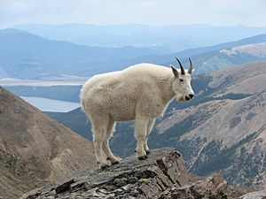
The Sleeping Giant is a very important place for wildlife. It's a critical home for mountain goats in Montana. You might also spot amazing birds like bald eagles, golden eagles, osprey, and peregrine falcons.
Other animals living here include bighorn sheep, black bears, elk, and mule deer. The streams are full of fish like brook trout and cutthroat trout. It's a true haven for nature lovers!
Fun Activities and Trails
Human activity in the Sleeping Giant area is kept to a minimum. This helps protect the wild nature of the land. There are a few dirt roads that are open at certain times of the year. One road, Medicine Gulch Road, is open all year.
You can find about 7 miles of trails for horse riding and hiking. There are also 40 simple camping spots along Holter Lake. These are perfect for a quiet night under the stars. You might even see old buildings from early settlers near the lake. They are not used anymore, but they tell a story of the past.
History of the Sleeping Giant Area
The Sleeping Giant's Past and Protection
The Sleeping Giant landform has been known for a very long time. Native Americans in the United States knew about it for centuries. Even tribes from far away, like present-day Minnesota, shared stories of this landmark. The famous Lewis and Clark Expedition explored this area in 1805. They camped near the Sleeping Giant during their journey.
The Sleeping Giant region was first made a wilderness study area in 1981. However, in 1982, a government official named James G. Watt removed its protected status. He thought the area was too small and had too many private land claims. But the area was given its wilderness study status back in 1985. It was even made larger in 1988.
In 1991, the BLM suggested to Congress that the Sleeping Giant should become a full wilderness area. This would give it even stronger protection. Over the years, there have been discussions about oil and gas drilling in nearby areas. However, the BLM has worked to protect the Sleeping Giant from such activities.
Since 2007, the Montana Wilderness Association has been working with local people. They want to build support to make the Sleeping Giant a permanent wilderness area. This would ensure its wild beauty is protected for many years to come.
 | Victor J. Glover |
 | Yvonne Cagle |
 | Jeanette Epps |
 | Bernard A. Harris Jr. |


