Slieve Snaght facts for kids
Quick facts for kids Slieve Snaght |
|
|---|---|
| Sliabh Sneachta | |

Summit
|
|
| Highest point | |
| Elevation | 615 m (2,018 ft) |
| Prominence | 600 m (2,000 ft) |
| Listing | P600, Marilyn, Hewitt |
| Geography | |
| Location | County Donegal, Ireland |
| OSI/OSNI grid | C424390 |
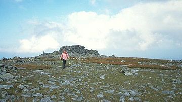
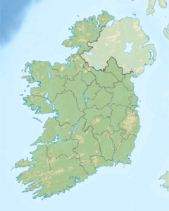
Slieve Snaght is a mountain located in the middle of the Inishowen peninsula. This area is found in County Donegal, Ireland. Its name comes from the Irish Sliabh Sneachta, which means "snow mountain".
Slieve Snaght stands tall at 615 meters (2,018 feet). This makes it the highest mountain in Inishowen. It is also one of the most northern mountains in all of Ireland. There is another mountain with the same name in the nearby Derryveagh Mountains. Don't get them mixed up! Slieve Snaght also has smaller peaks nearby. These include Slieve Main, Crocknamaddy, and Damph.
Why is it called Slieve Snaght?
The mountain gets its name because snow often stays on its top. You can sometimes see snow there until late May!
Slieve Snaght is also mentioned in old Irish stories. In Cath Maige Tuired, which means "The Battle of Moytura", it is called one of Ireland's "twelve chief mountains". This is a famous tale from Irish mythology.
There is a special tradition linked to the mountain. People used to make a pilgrimage, or a journey, to the top of Slieve Snaght. This happened during Lughnasa, an ancient Irish festival. Near the summit, there is a holy well called Tobar na Súl. This means "well of the eyes". People believed this well could help cure blindness.
How was Slieve Snaght used for mapping Ireland?
In 1825, Slieve Snaght played an important role in mapping Ireland. Surveyors used its summit as a key point. This was part of a big project called the Ordnance Survey. It was a huge effort to create accurate maps of Great Britain and Ireland.
The surveyors, including a man named Thomas Drummond, camped on the mountain's top. They even built a wall to protect themselves from the strong winds and weather. Drummond's team used a special light called a limelight. They shone this bright light from Slieve Snaght. It was aimed at another team led by Thomas Frederick Colby on Divis mountain. Divis is about 67 miles (108 kilometers) away! This was the first time a limelight was ever used for surveying. It helped them measure distances very accurately.
 | Victor J. Glover |
 | Yvonne Cagle |
 | Jeanette Epps |
 | Bernard A. Harris Jr. |


